| Author |
Message |
    
Ivan
| | Posted on Monday, May 15, 2006 - 10:17 am: | |
MORE ON ANZA BORREGO - Kumeyaay Indian village sites:
http://www.humancafe.com/discus/messages/1/74.html
Saturday, July 12, 2003
(from archived forums - Ivan) |
Ivan/glyphpicts
| | Posted on Sunday, July 22, 2007 - 10:20 pm: | |
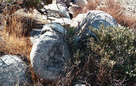
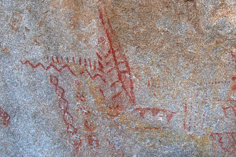
Pictographs at Anza Borrego desert, California - deciphered?
On the dirt road to the Kumeyaay site called Morteros, in Little Blair Canyon, a short distance past, there is parking turn around, and then as per the sign posted there, hike in about 1 mile (bring water), you will find ancient Indian pictographs on a large rock on the right side of the trail. These picts had long been a source of curiosity, since they do not seem to reflect any known pictoglyph writings. But upon examining them this weekend (Saturday, July 21, 2007), in total solitude under the hot desert sun (water was a necesity), using more instinct than knowledge, something made sense to me. So I share what I think I saw here. In effect, I believe this rock is a 'tableau' of information for those ancient Indian travelers who passed this way. It gave information on the desert's most precious resource: Water.
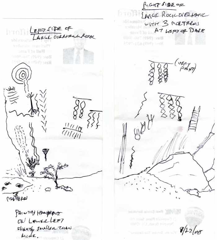
Here is a sketch I made (didn't have camera) while there, crude albeit.
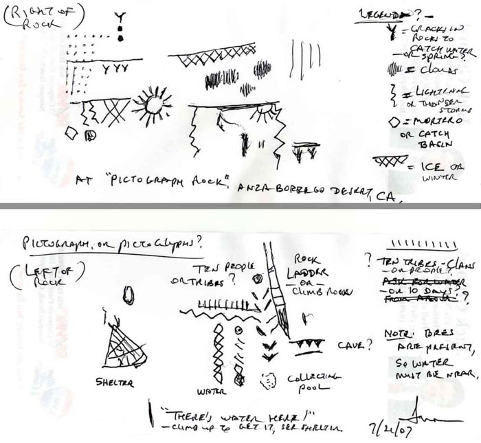
The 'writing' seems to flow from top to bottom, and right to left. The information it depicts, in my 'instinctual' reading of it, is as follows:
During the cold months (signified by the 'ice' criss-cross pattern at top right), during thunder storms, there will be water found from small springs (y indicates springs source) where the rain will gather in two pools (dotted rain connecting two pools)*, after lighting storms and clouds, and sun (obvious Sol) shining, look for the water. The next panel, on the left of rock, then describes how to find it. At right top is what appears to be a lizard, but it may in fact represent a 'rock ladder' indicating a climb. (The rocks at this spot are steep, with some vegetation present higher up.) It then shows a line with ten upright markings, which puzzled me, but I suspect it means there should be enough water for ten people.** Below that are markings for water (snake like, but not a snake), where it is shown in three columns as either flowing in a stream (connected beads at left), or dripping down into a pool, which should be located either in or near a small cave (parallel lines with three teeth, on right side of left panel), a clue of where to look. There should be some shelter (at an angle) on the side of the hill, which may have been erected back in ancient times for fellow trekkers.
These pictographs are being 'read' on pure instinct, or the kind used when communicating with persons who cannot understand your language, but having experienced it in my world travels, it does work. When I sat before these picts, bees buzzed me. I thought this could only be one thing: Water! It was an information stone for travelers, that there is water nearby. The fact that it is located on the saddleback between two large hills connecting two vast plains in the Anza Borrego desert of southern California, and there being no ancient Indian villages at the site (there is a mortero hole however), tells me this was not a habitation site, but a traveler's stop over, and this stone its sign post. The bees tell me there must be some source of water nearby, and the vegetation up the hill supports that. Being the height of summer, it may be no more than a moist spot, but during the rainy season, winter, there could be water flowing there. What currency is more important to desert travelers than water? And what kinder and more generous gift could anyone give in the desert than information about this water, especially in an area far from habitations? Indians had to trek to hunting plains, so in passing here there was information for them to follow, to reach water. I am not sure I have the 'ten' interpreted correctly, since it may mean this water belongs to ten Kumeyaay clans, or it could indicate some other numeric value (enough for ten people), but I am quite confident the stone has instructions on how to find water, by climbing up the rocky hill. The test, of course, to confirm this, is to climb that hill in the winter, after rainstorms, and see if it is possible to find a small cave with pools. By now, much of this would have been overgrown with vegetation, which opportunistically will grow wherever water appears. But any place where the bees buzz you more aggressively will give clue, and tell you you're warm, if you can stand them. And back in those ancient days, there would have been a well worn footpath leading up the hill to where part-time springs appear.
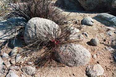
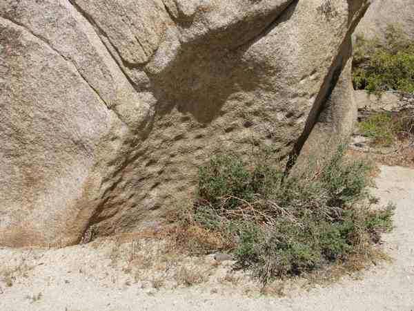
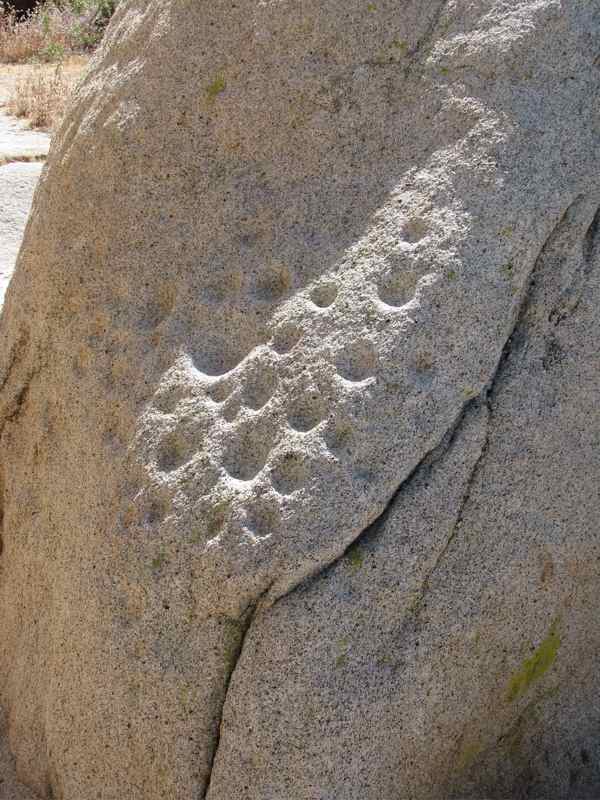
On a separate note, I wondered over the scalloping I see on rocks near Indian habitation sites, those used during the winter months by the Kumeyaay of the area, when they were not summering in the coolness of higher mountains. Most of the morteros (metates) at the sites were in the shadow of large stones, perhaps because Indians had used these as props for their crude winter shelters made of whatever materials they can find, mostly twigs and brush. But the scalloping is done on stones on the periphery of these sites, which leads me to think they were some sort of counting record. Knowing of present day pueblo Indians discomfort over having the spirits of the deceased nearby (they rather prefer them farther away), it might stand to reason these scallopings were a record of deaths within the clans at these sites on the periphery. This may have led to a practice where births were not recorded, but deaths were, but only if the total number of clan members increased beyond the existing record. So, indirectly, this could be a way to estimate how many people normally lived at any Kumeyaay site during the winter months, or at least how many the sites were able to support at the best of times when they were most numerous.
Just some thoughts, but thought to share them here. 
Happy hunting,
Ivan Alexander
Costa Mesa, CA
*[Correction, but the 'rain' is not that, but representative of an area suitable for planting, the dots representing 'crops' irrigated by the two springs connected to them. I had missed this, but saw it when I viewed the Nine Mile Canyon picts of Utah, where the village and crops fields on the left, and hunting abundance of big horn sheep on the right, in the Fremont Culture panel made it instantly evident. I suspect the central image of closed loops, with water at lower edge, depicts their village. -I've seen Indian villages from the air in the Amazon, and that's what they look like.- The row of jagged 'teeth' at bottom of panel are probably mountains (opposite of downward 'teeth', which may be caves), while squiggle lines most likely rivers and arroyos.
**(Subsequent research revealed the ten upright markings underlined, descending towards rock fall, represents 100 paces, which in fact brings one to the foot of the rock fall, marked by a large flat stone with a mortero hole in it, next to the trail. I took normal steps and counted a hundred, and it worked. Prior interpretations by others of similar |_|_|_|_|_|_|_|_| had them interpreted as 'spring', but that is likely wrong.)
My great gratitude to the artists who made these drawings all so long ago, and to the modern photographers who captured them for us to see today.] |
Ivan/glyphpicts2
| | Posted on Monday, July 23, 2007 - 06:44 pm: | |
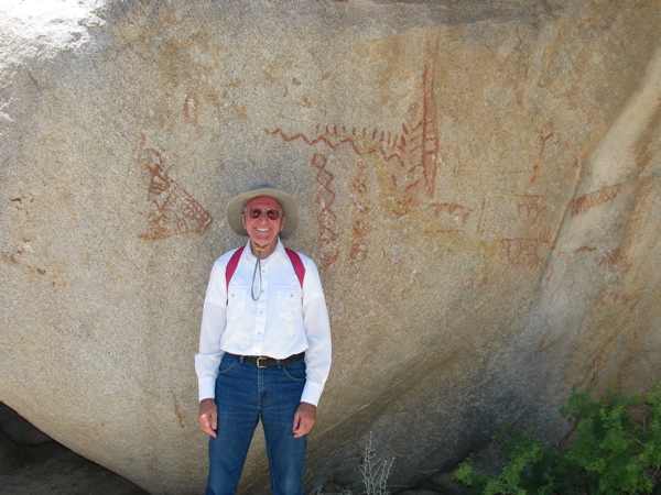
Pictographs at Little Blair Valley, Anza Borrego desert - photos of what was sketched.
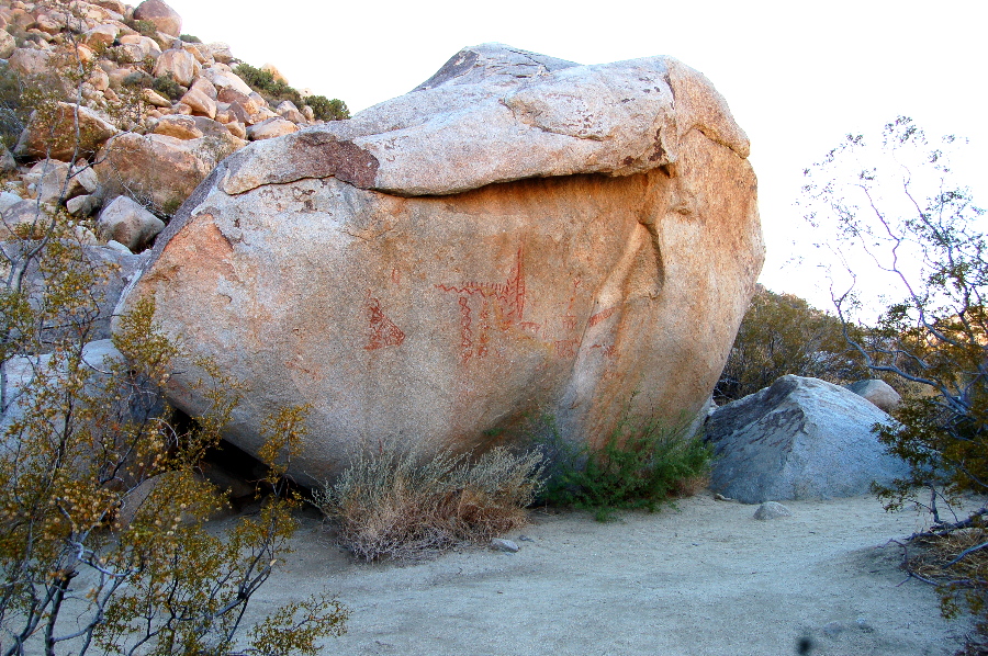 (interactive -click image for more detail) (interactive -click image for more detail)
This is the actual photo I found on web, of what I had sketched above (interactive), where it links to descriptions and other pix. Of course, their 'deciphering' of these is very different from mine! I should note there were very faint yellow lines, mostly faded, drawn beneath the "10" line, which I interpreted as representing "earth" or "sand", meaning "ten people of the land".** To the right of the beaded string, which I think means flowing stream (rare), the other two columns probably mean that most of the time the water is below the soil, or sand, progressively from flowing to nearly invisible. The middle columns has some very faint yellow in it too. The colors red, black, and yellow may have had a specific common understanding for the ancients who painted this.
(In many other sites, like at San Juan Pueblo north of Espanola, NM, where there are whole rocks full of pictographs, all on the west side of the river, away from their pueblo; I once lived nearby; the meanings may be entirely different from a 'sign post' to water. I cannot help but think of those rock 'scallopings' found at Morteros, and wonder if perhaps those too, far from the village, are not 'obituaries' of departed (adult) clan members over time. Some things we may never know.)
**(Subsequent research revealed the ten upright markings underlined, descending towards rock fall, represents 100 paces, which in fact brings one to the foot of the rock fall, marked by a large flat stone with a mortero hole in it, next to the trail. I took normal steps and counted a hundred, and it worked.)
Ivan |
Ivan/glyphpicts3
| | Posted on Monday, July 30, 2007 - 12:27 am: | |
A kiva or pueblo ladders* look like this:
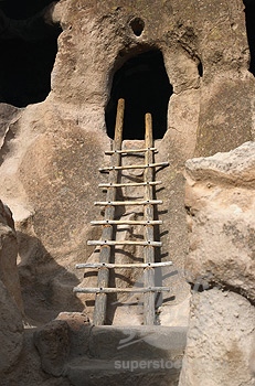
Here's a rock art kiva ladder, which resembles the ladder in the Little Blair Valley pictograph.
Note, the original Indian ladders were longer atop to make them more cantilevered, so easier to tilt and pull out of the kiva.
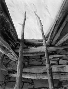
Compare this with the ladder pictured on the rock:
Still, it will take an in situ exploration to find out for sure. Hope to soon.
There are some more photos of Kumeyaay site at Morteros at the bottom of this page.
*[I can't find any online references to the type of ladder shown in the Pictograph (looks like a lizard next to rock fall chevron markings), and perhaps none have survived into modern times. I call it a 'rock ladder' because it has long handles at the top to make it easily cantilevered and pulled up, and the bottom comes to a point, so to better jam it in between rocks or on sand. This is a very sensible design for a people who had to climb over big boulders (and I know this for a fact!), to have such a light weight ladder available and easily transportable to where it is needed at the time. Too bad if none survived in any museum anywhere, not even at Acoma, NM., into modern times.]
See more on 'rock ladders' here: http://www.humancafe.com/cgi-bin/discus/show.cgi?tpc=88&post=4633#POST4633
Ivan |
Ivan/glypsDecode4
| | Posted on Monday, August 06, 2007 - 12:05 am: | |
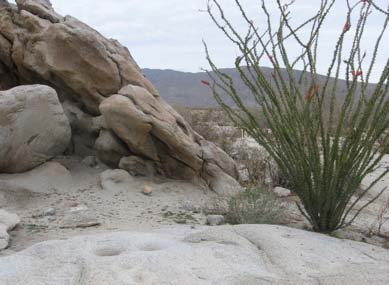
An in situ investigation of Pictograph Rock Art in Little Blair valley, Anza-Borrego Desert, southern California.
By Ivan D. Alexander
August 5, 2007
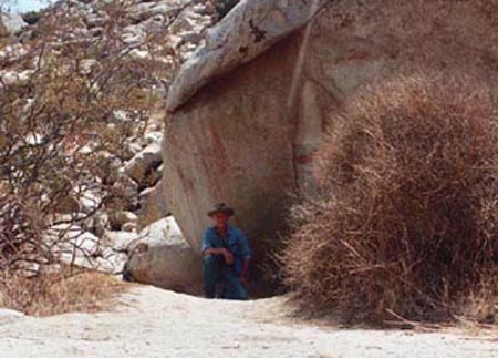
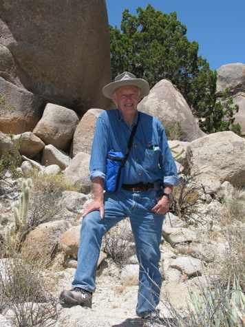
In the shadow of Pictograph Rock, self picture.
Introduction: In his beautifully rendered book "The Forgotten Artist, Indians of Anza-Borrego and Their Rock Art" [1], Manfred Knaak writes:
quote:Rock art in the Anza-Borrego Desert is primarily symbolic art. Occasionally a rock art drawing depicts something less abstract, such as a rider on horseback, perhaps commemorating an historical event, but most are abstract illustrations that may represent visions or dreams of the artist. p. 36
From researching works on rock art in the American Southwest regions this appears to be a commonly held theory by most scholars, especially in more recent times, that rock art is shamanistic and magical. [2] However, earlier interpretations tended to be more pragmatic, that some such rock art was informative, such as showing sources of water, or hunting trails, or perhaps villages and agriculture, or game present. This was the natural interpretation given by ranchers and non-academic travelers who happened upon these ancient art forms, such as this Fremont Culture panel [3], Utah, which shows some common characteristics with panels in Anza-Borrego's pictograph [4] at Little Blair Valley. It may be assumed that beyond their magical shamanistic interpretations, some such rock art was meant more as a 'marker' of information. In "Stone Magic of the Ancients" [2] the authors write:
quote:In some cases a trail marker is apparent by its location. There are examples of markers carved in horizontal rocks that seem to lead directly to the head of a petroglyph-filled canyon or other concentrations (Young 1990). Often there are water-related symbols near hidden natural springs. You can understand the utility of this if the spring is located in a distant hunting or traveling area where people might need help in locating water. Petroglyphs have also been known to mark the mouths of cool caves where soot-covered ceilings tell us of extensive use during some era.
Many of these symbols, such as trail markers, would be readily recognizable to the members of different tribes. ... p. 24
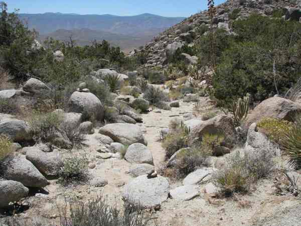
Field Report - investigating Pictograph Rock site: It was as such, a 'marker', that was my impression upon seeing the pictograph at Little Blair Valley (also called Smuggler's Trail) on the large upright standing rock. My first impression was that it meant a marker for information to travelers passing by. [4] My interpretation was that this set of art pictographs described rather clearly that there is seasonal water near, mainly during winter's rainy months, marked by images of storm clouds, lighting and rain (vertical lines), and ice (criss-cross pattern) up the rocky side of the small mountain behind it; with additional details of where to find water, and what markers to look for in climbing. If this was to be shown true, it would require an in situ investigation, by climbing the rocks as the pictographs detailed.
Ideally, to prove this hypothesis of the stone marker for water, the climb should be done in winter, or the rainy months when water would be present. However, I felt it as important to climb up the rocky mountain during the driest and hottest months, to test the theory that the markers are plain to see even without presence of water. Typically there are virtually no tourists in the Anza-Borrego Desert during early August, when day time temperatures often hover over 100 F, so it was no surprise that I should be totally alone on this search. This allowed my focus to be totally concentrated on the site without human interference. Armed with camera, binoculars, two water bottles and a snack of almonds, I set off shortly after noon to explore pictograph rock, a short 20 minute walk from the car park at the trail head.
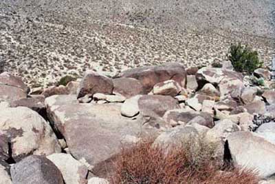
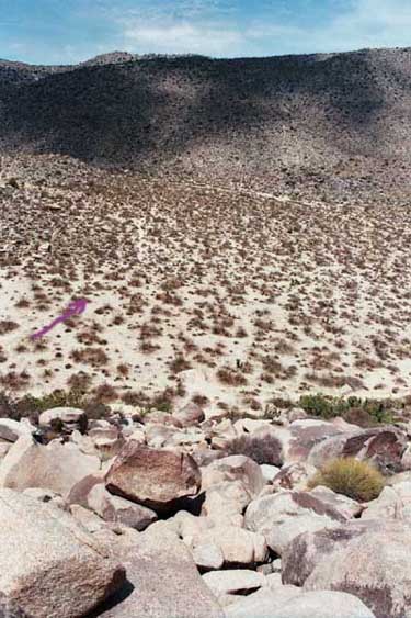
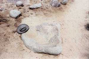
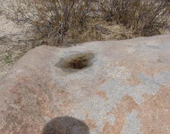
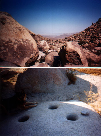
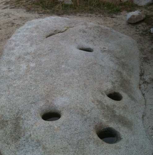
My first objective was to get a panoramic sense of the site, so I walked off into the dry valley to get a whole view of the mountain site. From a few hundred feet back I could see a rock fall on the mountain side that could also be a rock strewn arroyo (dry wash) going up, which had the peculiar rocky character of a fish bone pattern similar to the pict just left of the rock ladder depicted (left panel). This was my first clue, since I assumed the rock ladder pict represented a climb. From my distant vantage point I could make out what appears faintly to be the beginning of a trail going up at bottom left of rock fall, but which seemed to continue across it on the right side higher up. About a third of the way up the mountain there appeared to be a depression, more like a mini-valley stretching to the right, and atop the rock fall were some large boulders, which I thought could be a site for the springs. So I set my sights on those markings, and began my climb. But before I did that, I walked back from this faint trail head to the pictograph rock. I counted one hundred walking steps from the pictograph rock to the large flat rock at the foot of the rock fall. I found this curious, remembering the ten upright markings, but inconclusive still as to what those markings were for.
View of mountain from valley (arrow shows path, Pictograph is large boulder at far left of pict); up the 'staircase' rocks (three tooth 'cave' is rock at top).
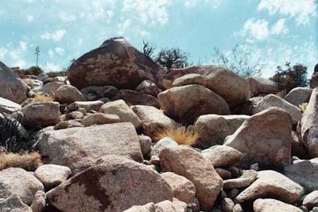
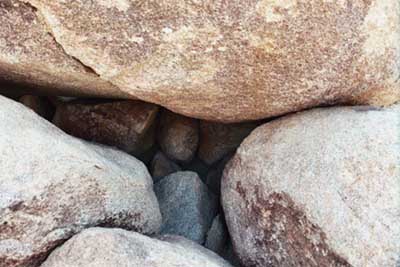
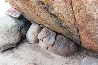
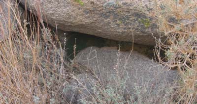
Just past the large boulder at the bottom of the rock fall, which may be marked as a indistinct circle on the pictograph (left panel, I had originally interpreted this as a 'pool'), the rocks seem to have a natural 'staircase' pattern to them taking me up and to the right, which I followed easily. Stones may have been placed here purposefully to ease the climb. What may have been a trail long ago to right of rock fall was now covered with bush vegetation, at times grasses or 'mormon tea', or desert cyprus, as well as a variety of cacti and agave, some flowering. I continued climbing the rocks until I came to my first marker, which looked like a small cave part way up the rock fall. Surprisingly, when I looked into it, it had three rocks inside, which gave it the appearance of an open mouth with three teeth. This increased my curiosity, because the pictographs showed such a pattern (left panel) though here it was portrayed at the bottom of the ladder rather than higher up. Later I may found a reason for this, which is most interesting.
'Three Tooth' cave; Flat Rock with (upright) stone and fire pit; Pictograph Rock (see 'three tooth' image);"Y" in rock (small blue arrow).
My ascent took me above the small valley to the right, to get a better birds eye view of the place, which took me to what appeared to be a large rock under which was evidence of water having left stains there, which may be one of the springs depicted with Y in the pict (right panel) near the top of the rock fall. Looking down from there I could see a line of small rocks traversing the rock fall just about level with the small valley (which is now on my left from where I stood), though it no longer was a wall, but merely a line of fallen rocks. My impression was that if it were a wall, it had long since collapsed, though it was in the right place to channel water towards the small valley, if used for irrigation. The valley itself had some large boulders in it, but there were clear places where crops could have thrived. So I began my descent towards the small upper valley and passed another large rock under which could have also been a spring. This spring would have descended more directly into the field, but not conclusive without presence of water. Then I descended into the field, which had a large gnarled juniper tree in it, and just past there was a large flat rock, large enough for people to sleep on. On this flat rock at one end there was a fairly large standing stone block with a small depression before it. My imagination immediately jumped to a fireplace, the kind one would have if this were a sweat lodge, meaning the rock was covered with a shelter of branches and skins. To activate the 'steam bath' one had to heat the rocks and pour water on them. In fact, there were large and small rocks within the cavity. This made me think the 'shelter' depicted in the pictographs (left panel) could have been this site, perhaps a sweat lodge, which could be the strange longish pict above the 'shelter' on pictograph rock (left panel). But the location on the pictograph rock was reversed, until I understood the artist was painting it from his point of view, which is from above, rather than from the valley's point of view, which is below. Once I understood this, it all made sense that the shelter, which is to the right of the field is actually to the left of it, when seen from above. This would also explain why the crop fields and springs shown in the pictographs (dotted lines in right panel) show the irrigation line going to the left, which is how it appears when looking down from up the hill at the spring. The line of small rocks, which may have been an irrigation wall, go to the left! I began to understand the artist's mind better, that he drew what he saw not as I wanted to see it but from his experience, which was from up the rock fall. But to another Indian who saw this rock art, it would have made instant sense, that everything depicted was from above, and not from below. Now I wanted to climb further, above the small upper valley, to see where the arroyo that came down from further up the mountain would lead me. (I was now following up the 'line' with 'three ys' shown connecting to the 'crop field' in right panel, which I think signifies a seasonal stream with three sources flowing down the mountain.)
Hard to picture, but 'pool bath' (I could sit in it); view over top of mountain at other valley towards Aqua Caliente.
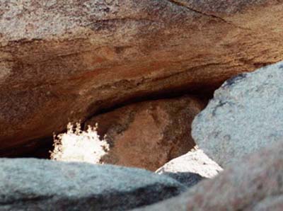
A short distant past the field I came across something that was intimately familiar to me, because I had bathed in one near Lamy, NM, train stop, southeast of Santa Fe. Below the railroad trestle there was a stream, and up that stream there was a natural pool built into the rocks where the water came down. Here was the same thing! Large stones had been placed in such a way to catch the water flow, and stones from inside the pool had been removed, so a natural cavity resulted in which one could bathe. This was only steps away from the supposed sweat lodge shelter, so it made sense to me. However, whatever trail had existed long ago was now gone, mostly, since bush vegetation had grown in. (It was a chore to not get stabbed by cholla cacti and agave plants, though it did happen a couple of times when not careful.) Continuing further up this arroyo until I got to a large rock that offered shade, which by this time my weary dehydrating body found welcome. It was hot and hard climbing. Sitting there I saw under the rock, from which behind water would flow in the rainy times, a small "y", which reminded me of another rock I had seen at Morteros which had a number of such "y" carved into it, just below a hollow in the flat top of the rock so excess water would flow there. Could this be why the artist used this image to symbolize a spring? I was intrigued, so after a rest continued to the top of the hill. There were flat sandy areas there, but unsuitable for planting, in my opinion, since the soil was rocky and poor. Past these I could see far off into the distance of another valley. As I stood looking down, a military jet flew by below me, flying low over the valley, which led me to believe I must have been over five hundred feet up from the valley. With good visibility in the distance I could see the serpentine S2 roadway heading south, with the turn at Aqua Caliente on far left, and the small air landing field there. This was a treat! Returning I passed some rocks near the top that seemed like a natural lookout place, which large stones that could pass for a fireplace. To mark my presence, not using graffiti, I piled some small stones on top, with a (1975) penny inside, just for fun. On the way down, I did the same again by lodging a penny (1971) into a crack of the large rock of the bath pool. By now my fevered brain cooked by the sun left me punchy, so had to be extra careful with all I did to avoid a fall, but upon retracing my steps down to the 'shelter' I could have sworn I saw more pictographs. One was inside underneath a large rock, showing the same upright markings and diamond network for water, except this was heavily encrusted with mud, so hard to read. (There were mouse droppings, so be careful not to touch them, very dangerous.)* Also, when I returned to the flat rock 'shelter' area, just to the left of it I thought I saw a pictographic representation of a man, badly damaged but painted in black on a split rock that had black surfaces to it. But this may just have been my imagination, since by now three hours into my ascent, I was beginning to see things, and thirsty.
Seeing things, but looked like pictographs (horizontal diamond strings) underneath the mud; another 'ghost' pict; arrow shows faint trails valley below; typical hollow rock, on 'hunting' trail in valley.
Looking down to the large valley floor from where I started, I noticed the flat rock at the foot of the rock fall, on the other side of the walking trail there, that it had a small hollow depression in it. I had noticed such depression in other flat rocks from the car park walking to the pictograph rock, and wondered about those. Disappointed at not having found morteros up this hill, especially near the 'shelter' except possibly some flat metate stones, I wondered about that in my dehydrated state. If I were hunting game in the desert, what would I use for bait? Water! What better way to attract game than to offer what it craves most in this dry environment? So if I were a hunter, I would position myself downwind (a breeze prevailed from the west while I was there, which was refreshing, especially when sitting in a shade) and leave some water in a hollowed rock for them to drink. Game would be attracted and it would be a natural way to hunt it, most likely with bow and arrows. I also noticed from up there that there were trails in the large dry valley below, one of which went to the other side and connected with another one that headed to the left and right going into other valleys, so there may be vestigial remnants of ancient trails. If this location was important, not merely for magical rite purposes but also for pragmatic purposes of refreshing hunting parties, then these trails make sense. This rock fall area was a gathering place, which may explain why no permanent settlement was here, and no morteros except at the bottom (there is one at pictograph rock), so trails converged here. I also wondered about that when I was over the top of mountain, because it looked like a trail going down to the other valley, and wondered if any of it connected with the Morteros village site, where Kumeyaay Indians wintered in ancient times, some four miles away. This may have been a meeting place, and pictograph rock is simply marking the spot.
Discussion: Surprisingly, I did not again encounter the bees I saw only two weeks earlier. Could the extended drought we had been having in the southwest, especially here in southern California, finally do them in? When I got back to the valley floor, I left some precious water from my bottle in the hollow of the rock, which still showed a ring of moisture from some past rain. It was done as a token of my thanks, maybe the bees will find it, and also to the Indian spirit guides who so graciously led me to understand something of their past. Theirs was not a primitive culture, not merely shamanistic magic, but a profoundly practical one, clear minded and captured so intelligently by their artist in his art rock. Were these pictographs used for magic? Perhaps, in some later times when their original message was forgotten. Cultures do move on, and old ways are forgotten. When in antiquity Romans and Greeks, both excellent builders, came to Egypt, they marveled at the great statues and temples, especially the pyramids. But by then, Egyptians had forgotten how to build pyramids, same as ancient Indians may have forgotten what these rock painting were symbolizing. By the time of the Spanish Missions era, these rock paintings may have been as mysterious to the Indians as they are to us. Or, if one may be sinister, the Indians did not wish to divulge their secret meanings to the newcomers, who were invaders of a people who learned to live skillfully in such a dry and difficult environment. To go through the trouble of building such a network of water, and then to advertise it to passersby, is an act of immense generosity and goodwill, not common to warring tribes. The Kumeyaay, and their predecessors, may have achieved a high level of culture and civilization that had regressed into decline by the time of our arrival here. And if a missionary or archeologist asked the Indian what these markings mean, he might have as easily led him astray to their true meaning because he simply did not know, or perhaps tongue in cheek, he nodded in assent with whatever wild speculation the archeologist threw his way. If he wanted to believe these were for girls puberty rights, why not? Except there is a flaw to this line of reasoning. If these paintings were done for puberty or other magical rites, why are there not thousands of them? In fact, I thought about that while staggering back to the car as the sun lowered in the sky, why are there so few? Or were all those faded scratchings my fevered brain was seeing on all those rocks but remnants of such puberty magical rites, but now faded beyond recognition? Are there two cultures evidenced here, one ancient and intelligent, which was clear in what it wanted to say, and the other more modern but steeped in shamanistic magic? One can assume that pictographs and petroglyphs depicting horses or Christian crosses are of the latter, post Mission period, but what of the Kumeyaay sites that predated this? There were no such markings on Pictograph Rock, though a horse may be on the rock art at Morteros, in red, but not clearly visible from its mud covering. Two different periods, with two different cultures, perhaps? Am I reading too much into this? At one point, I even thought I saw bird droppings look like a pictograph! It was time to stop myself, or I would go off into some fevered 'shamanistic dream' not of my chosing. Obviously, the next step is to reason it out carefully, compare these markings to others of the southwestern deserts, and see if there was a 'common language' present in ancient times for their rock art. One common symbol is the concentric circle, or spiral, especially when connected with serpentine lines. [5] Water again? If the Fremont culture [3] used similar markings as the Kumeyaay, though separated by hundreds of miles, or similar ones found in Nevada, Arizona and Mexico, then there is cause to believe that, like Chinese ideograms, their spoken languages may have been different, but with some of the symbols held in common, all would understand them. This is not to detract from the idea that these symbols were magical, perhaps even some graffiti, but there may be more reason after this field report to believe also that the messages marked in stone were in fact real information. If I was able to 'read' them, and find the clues the pictographs portrayed, so would have ancient travelers migrating on their way to hunting grounds. The next step will be to return to this site when the waters are flowing, to better test this theory. Oh yes, I also left a penny (2001) at the foot of the rock fall inside a small pile of rocks marking the ascending trail. This is my own benign in situ 'graffiti', though not a match to the fine artwork of the Kumeyaay artist of long ago. But I still have no idea what that line of ten upright markings are meant to mean, unless a line drawn under ten means 'times ten'(?), or a hundred paces?
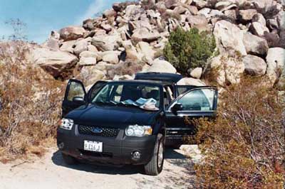
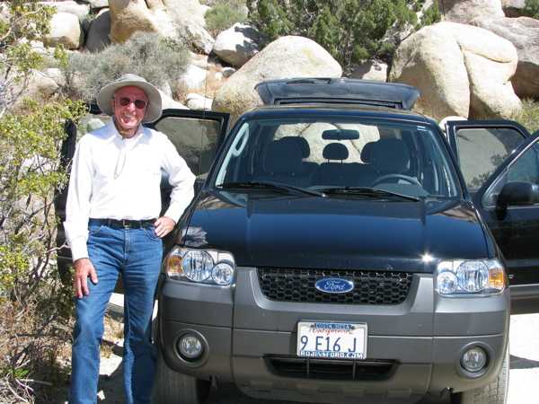
My 4X4 hybrid-car was broiling hot upon return; rare bloom in the desert despite drought.
For anyone interested in seeing more of these sites, there is a lovely little book, "A Guide to Rock Art Sites - Southern California and Southern Nevada" by David S. Whitley (1996). Another valuable source is from the School of American Research, Santa Fe, New Mexico, "Indian Rock Art of the Southwest" (1980). Again, my special thanks to the wonderful works by Manfred Knaak [1], and Cunkle & Jacquemain [2], for making this research so delightfully interesting.
Ivan D. Alexander, Costa Mesa, CA
References:
[1] "The Forgotten Artist, Indians of Anza-Borrego and Their Rock Art", by Manfred Knaak, (Anza-Borrego Desert Natural History Association, 1988).
[2] "Stone Magic of the Ancients", by James R. Cunkle and Markus A. Jacquemain, (Golden West Publishers, 1995).
[3] "Nine Mile Canyon Rock Art Site", Petroglyphs.US, http://www.petroglyphs.us/photographs_rock_art_nine_mile_canyon_utah_NM.htm
[4] "Pictographs at Anza Borrego desert, CA - deciphered?" by Ivan Alexander
http://www.humancafe.com/cgi-bin/discus/show.cgi?tpc=6&post=3974#POST3974
[5] "Indian Rock Art of the Southwest" (1980) pp. 87-94,
*[As a footnote, please be respectful of all ancient Indian sites, for they are fragile. These sites are truly a marvelous legacy to be preserved for all in the future. But a word of caution: Hanta virus is present in the desert southwest, so do not disturb any mouse droppings; it's a terrible disease, with 50% mortality, and you do not want to get it; I know, because I had it three years ago, contracted while clearing debris and droppings out a rock hollow to pour water for my dogs, and I was lucky to have survived (even dogs got sick with a loud cough, but recovered in a few days, for me longer). Otherwise, use caution, be constantly aware of possible dangers, bring water and snacks, and a hat, and enjoy the desert beauty, because even if it is hot and you are totally alone, it is a truly wondrous experience to be there.] |
Ivan/Kumeyaay5
| | Posted on Sunday, August 26, 2007 - 02:01 pm: | |
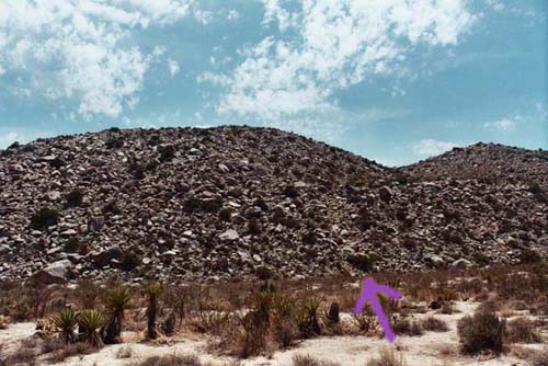
(2)Kumeyaay red 'flags' were a surprise, at Little Blair Valley, Anza-Borrego.
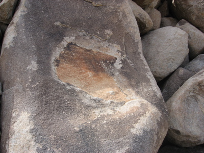
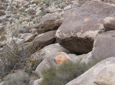
I went back to Little Blair Valley (aka Smuggler's Trail) to see if I could find some other pictographs there. My intention was to take the trail across the valley (see above picture of trail, with purple arrow), which was easy to find and follow. Most parts of the valley are studded randomly with some vegetation, mostly cholla cacti, but this trail was clear and relatively straight. Surprisingly, it had few animal tracks, and not surprisingly no human footprints. So this was an old trail crossing this little valley to connect with another trail that ran the length of the valley, mostly north-south along a natural arroyo. When I got to the other side, I walked south first, just to see if any markings were left by the Kumeyaay, hoping to find some indication across the valley there was either a pictograph rock or seasonal water depicted. But I found nothing on the rocks. Then looking back towards where I had started, I noticed a large red panel, rectangular in shape but clearly visible to the naked eye, just over where stood the large Pictograph Rock. (see #1 below) This was surprising, so I made a mental note to check it out better when I got back. Then I proceeded north into the �upper� Little Blair valley, starting where a trail from Pictograph rock joins the dry wash here.
Within a short distance, about 250 paces (~150 meters), on my left (west side) of the little valley I came across a large rock (much smaller than Pictograph rock) which I can only describe as a large 'yoni' cut into the rock*. It appears natural, but faint trails were around it going up the small hill, so I did too, but found nothing else of note. When I got to the northern end of this valley, I scanned rocks with binoculars to see if anything showed up, but found nothing. Well, not entirely nothing, since on one large rock on the eastern side, where the valley opens up, there was another one of those rectangular 'flags', again colored red, which now really got my interest. (see #2 below) First of all, the rectangle is not a common shape in nature, so it appears almost immediately the hand of man. Then two, one at either end of this north-south valley, one on western side and one on eastern side, now began to look like something somebody did with intention. Could they be 'boundary markers' for this particular clan? I got there to investigate and found nothing other than natural cave like shelters, with some trace evidence that water flows there at times, but no pictographs or morteros. Still, it made a cool place to sit, with an obvious fireplace, since the overhead rock was blackened, and not recently but very long ago. When I got back to Pictograph Rock, I climbed behind it, only about 30 feet up, to get to that red 'flag' I could see from across the valley. Again, I was surprised.
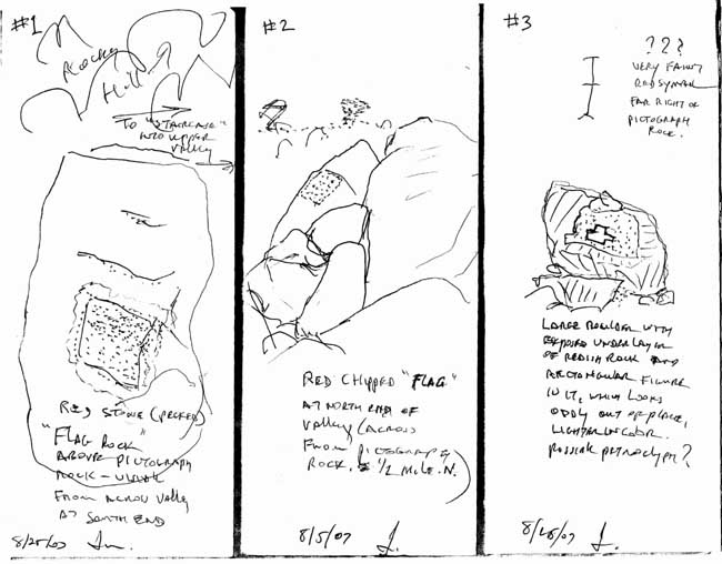
Quick drawings of what I saw, next time bring camera.
(Note: at far right of Pictograph rock is this little stick figure #3 pictograph, which may mean "trail over the mountain", with both end markings representing 'valleys', and cross-stick the mountain summit; in fact, I had climbed there and it looks right as represented.)
This red flag' over Pictograph Rock was a 'trompe l'oeil', because what looked like a very nice upright rectangle from a distance was actually not so perfect up close. In fact, it had been chiseled to appear straight lined, except the bottom right which was not, but used the natural curvature of the boulder. The method used to create this 'flag' was to remove a flat capstone over the boulder to reveal the reddened oxidized stone below (the original cap stone was left in situ just beneath the boulder, where it slid down), however because the sides were uneven, they had hammered the rock to 'erase' the reddish hue from where needed to give it a straight edge. The markings of hammerings are still visible today! So they manufactured a rectangle from a natural formation, revealing the reddish color beneath the capstone rock, but then refiguring it so that it would appear as a rectangle from a distance. How smart! I did not have occasion to go back and inspect further the one at the northern end of the valley, except when there, it looked tampered with too. So were they 'flagging' these sites as being significant? We know Pictograph Rock is significant, because it has paintings on it. But the other rock only had some rude shelters. Now I was intrigued, though it was not what I had hoped to find. In fact, I never found more pictographs. But if passersby in ancient times, on their way to a hunt or neighboring villages, saw these flags (they are clearly visible from a distance), they would have known how to interpret them: "Something of interest here, come and check it out." Smart. There are almost no red rectangles in the desert formed naturally, so seeing one automatically tells you man had been here, and has something to do with it. Also, I did see many animal footprints when hiking that valley across, mostly coyote and big horn. In fact, there were new coyote tracks and fresh scat, still buzzing with flies. Was I being followed?
So it was really a pleasant surprise to find something I never expected. I was looking for more pictographs, but got rewarded with more than that, since it again gave me insight into the Kumeyaay mind. They wanted passersby to know what was here. When I finally walked back to my car, just before I got there, I again spotted (now I knew what to look for) a large red 'flag' by the side of the trail, just before the car park. When I climbed up above it, there was a very small shelter, unlike the larger rock shelters at the car park, just a few steps away. But as I sat there, tired and cautious to not fall, I noticed a similar rock phenomenon across the way, where the cap stone rock had slid away leaving behind a faint reddish hue. But this was not rectangular, except that within it was what appeared to be chipped away (through the reddish hue) a whitish shape, which was rectangular again! (see #3 above) Except this was not a mere rectangle, but it seemed to show the length of the valley with the small upper valley above it, and a small piece jutting to the right, which was where I was at the time. So was this a 'map' of this area, perhaps demarking their hunting territory? I cannot know, but it stood out. The car park does have some rather nice rock shelters, I've even used them to get out of the sun, and again there is evidence of fire, but can't say if old or new.
The sun was setting by the time i drove off, but I still had time to see the abandoned 'ghost' Marshall South adobe homestead nearby, or what's left of it. So when I got there, the sign said "hike 1 mile", and though the sun was about to set behind the mountains, I thought I'd do a quick hike up to see what's left over. Marshall and his wife Tanya had tried homesteading here during the Depression, but it proved too difficult to live off the land, especially since all supplies had to be carried in. In fact, she left him there. But a short hike, though by now my legs ached, at sunset seemed the thing to do. As I started up the mountain, I was rewarded by a spectacular sunset, once the sun broke the clouds over the west, and it was beautifully glorious, making all the valley and rocks around pink. Tackling the switchbacks was not problem, except they never ended! By now I was way up the mountain, just in time to catch a nearly full moon coming over the top, but it was getting dark, and I was tired. Well, got this far, can't quit now, so I kept going up. If Marshall could do it, so could I! However, just before reaching the ridge where he built his adobe home (he must have been crazy, you can't even see the valley from there), I got greeted by a very loud and very determined rattle. I had heard rattle snakes before, this one had a higher pitch, probably still young, but I had trouble seeing where he was, since it was getting dark. Finally I saw him right in my path, and even tossing a few pebbles left him unmoved. So I clambered over some rock to go around him. By now the 1 mile hike felt like 3, but I had to get to the top, lucky I brought water. When I got to see the old adobe homestead under the darkening sky, more by moonlight, it was unimpressive, except why in the name of God did he build here? It was impossible to imagine. The rain cistern was still there, as was a shallow pool for bathing, but the place was desolate, no road, only that miserable trail. I can't blame Tanya for leaving him! The adobe walls are mostly fallen in, but the metal bed is still there, if darkened by rust and time, and I think I could identify what was probably the fireplace. Anyway, had to get back down before long, and once again on the trail I hear that same rattle. Okay, so he lives here. I climbed the rocks again to get around him, though I could barely make him out in the dark. Well, so it goes when in the desert... look out! The rest of the switchbacks descent was easy, and I was glad to get back to the car, by now about 9 in the evening. Once again, I was the only human here, nobody else anywhere nearby, but I did find old footprints, so somebody was here, maybe a week ago.
What did I learn on this jaunt? The Kumeyaay Indians were smart, they knew what they wanted, and they did not chatter about it. There is no profusion of pictographs or petroglyphs here, only what needed to be said. To put up red 'flags' in stone is so smart, because it required minimum labor, but it got the job done. I also noticed by Pictographs Rock, when I was climbing behind it, there was a large black boulder with a large natural depressed groove in it, so when it rained it would have acted as a catch basin to send water down. I could find no natural cistern, but there was a large flat rock near the bottom that had a large depression in it. Perhaps they caught water in jars and poured it there? We'll never know. But to go back during the winter rainy season is now top priority. I must see what they saw, so long ago, because they knew what to do.
I have one more observation: there are many hares and lizards and coyotes present in the desert (and rattlers!), but they are not what is depicted by the Kumeyaay, which leads me to think their rock art was not as much 'shaman' art as simple direct informational markers. Perhaps in other parts of north America shaman art was more important, but here they really stuck to basics. What is art anyway? It is how we related to our life in this world by what is our connection with it, or fails to relate in order to distance ourselves from this world, so we represent our art either graphically or abstractly. Either way, art says who we are. The Kumeyaay seemed pretty clear as to who they were. They were direct and didn't waste. I like them more with each visit.
*See image of �yoni� rock here.
Ivan
(Ps: I was kind of 'out of it' out there, though it was only about 100F, but my dates on drawings make no sense! It was August 25th, 2007, on all three. Also, in #3 at top there is a stick figure, which is far right of Pictograph Rock, barely visible. I wonder if this might be the artist's signature?) |
Ivan/Kumeyaay6
| | Posted on Wednesday, September 19, 2007 - 01:25 am: | |
More on Kumeyaay Morteros and Caves site, Anza-Borrego, at "First Americans" page: http://www.humancafe.com/cgi-bin/discus/show.cgi?tpc=88&post=4096#POST4096
I keep finding these interesting 'red flags' of stone out there, where the Indians found shelter from the elements and, most important, water. But still must check it out further, awaiting the winter rainy season to confirm everything.
Ivan |
Ivan/pool bath
| | Posted on Monday, November 12, 2007 - 09:38 am: | |
Addendum: to Pictograph Rock above.
The small oblong circle above the 'shelter' (sweat lodge?) is most likely the small 'pool bath' up the hill in the part time stream/arroyo above the shelter (see next post below linked for pix). I will be there during the winter rainy season to confirm, will report.
Ivan
[Ps: At a later date, Jan. 2010, after substantial rains for five days, I returned to the site up the little 'hidden' valley in search of water. Not flowing water, but interesting morteros water, which I wrote up here: http://www.humancafe.com/discus/messages/1177/1741.html?1264532997#POST5412. The Kumeyaay may have found an intriguing way to harbor water in the rocks. -IDA] |
Ivan/Kumeyaay7
| | Posted on Saturday, February 16, 2008 - 10:37 pm: | |
Some new pix from Pictograph Rock and Kumeyaay site - 'red flags' continued from above.
'Red flag' from valley at Pictograph rock, and detail of 'flag' over Pictograph Rock (boulder), another 'red flag' down trail towards car park (shelter rocks)
These similar flags were evident, though on a hazy grey day not too visible, from most sites that showed evidence of shelter, or water sources during the wet season (top left pict has 'red flag' in third boulder above Pictograph Rock, right upper end of second large boulder). From across the valley the 'red flag' (in second pict) appears square, a trick of the eye. This winter had been once again very dry in the desert, so whatever water sources may have existed still remain elusive, except for some wet spots. Up in the 'valley' above Pictograph Rock there was good evidence of ground moisture, and some wet spots under rocks, but not much else, as it had rained only about 1/2 inch in January, end of which I visited the site.
Here are some pix showing moisture:
Blooming ocotillo (Mine Wash site), green moss under rock, overnight rain in mortero hole
But the evidence of flowing water, whether above ground or under, remains illusive for now. No conclusion as to whether Pictograph Rock's instructions, to walk 100 paces down trail towards rock fall, and then climb there (see bottom pict for 'rain puddle' inside mortero at bottom of rock fall, which is where you climb to get up to little valley above, suitable for crops and shelter), is true or not. Will await further evidence, inconclusive. One hopes ancient times were wetter, or survival in this desert would have been very hard, even if capturing water runoffs in pots and baskets. Will return when water is coming down hard, flowing in known streams, most of which were fairly dry this time.
Ivan |
Ivan/Kumeyaay8
| | Posted on Sunday, April 06, 2008 - 12:34 pm: | |
Kumeyaay Indian 'Caves' at Mine Wash road (dirt track) off CA 78, about 2 miles in, on left there is a tableau.
Anza Borrego Desert State Park of Southern California (click on map for more details) -
or download PDF map of the park, available at Visitor Center in Borrego Springs.
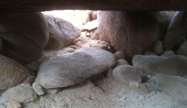
I returned yesterday to explore again the 'caves' which I had visited before. They are up the second rock fall past the morteros visible from the desert floor. It was a pleasant day, sunny and comfortable, but very windy. I tried to find the cave with the large flat rock inside but after three hours of hard climbing, with my hat blown off at times, which luckily did not fall into a crevasse (and lucky neither did I!), I had to abandon my search. Though I found new large caves, some of which had human footprints inside, and lots of coyote scat or desert hare droppings, I only managed to see the cave I wanted from above. Try as I might, I could not find my way down into an entrance without seriously risking life and limb. How did I find it the first time? I must have crawled out of one cave into another, and though I am pretty sure I was in the same place (outside the 'kiva' cave there is a large horizontal rock with carved depressions in them - probably to catch rainwater - I found another such well carved 'bowl' looking down into a crevasse) I could not find my way in. My frustration was compounded by dangerously buffeting winds, which left me tired of all that climbing, since the boulders there are quite large and hard to maneuver. The Kumeyaay seemed to leave hand holds carved into the rocks, and foot holds, and often positioned large stones to make the climb easier, I must admit I admire their climbing competence on such treacherous rocks. A slip and fall could prove serious if not fatal. At times I had to crawl on my belly to get to the next place, and a near fall warned me that I was getting tired and should stop. A rest from climbing and grenola bar replenished my energy. Always bring lots of water.
On reflection, I suspect the 'caves', which are really hollow places beneath large boulders, may have been cleaned out of dirt and sand to make for more comfortable habitations (there was no wind inside the caves), but things may have changed in the past two centuries since they lived there. Rocks caved in, sand blown in, so what we see today, after centuries of earthquakes and weather, may not be what they had then. Also impressive that later visitors left no evidence, either as graffiti or rubbish, except for some crate pieces laying around (which someone probably left with intention of returning and using for firewood), there was little evidence of visitors (except for footprints, some of which were mine!), so the place remains pristine. Other couples, some with children, were visiting the morteros while I was there, but none climbed up the second rock fall. I suspect this is a place little explored, but fascinating because that seems the most logical place for the Indians to use for shelter, though hard climbing. They must have been a tough and spry bunch to live there! Not to mention snakes and other dangers climbing in those caves.
On the drive back I stopped off at the Visitor Center of the Park Headquarters in Borrego-Springs and got some new maps (see PDF above), and talked to a couple of volunteers. One older woman and I shared our experiences four wheeling on the Pinon Mountains road, which is a tough one. She had come in from the Wind Caves direction, but had to stop about half way when they got to a very steep climb on rough boulders; I had seen it from the other directions, just past the 'squeeze' as its called, where the rough boulders road drops off precipitously. Either direction is fun going, but that 'squeeze' makes it nearly impossible, though she said others had done it. I can't imagine doing it without serious damage to the vehicle, that part more suitable for mules than trucks. We also talked briefly of my report on the Pictograph Rock in Little Blair Valley, but I didn't go into much detail, since the findings there are still inconclusive. She mentioned a book by Lowell and Diane Lindsay which has good information on the Kumeyaay, and I told her of Manfred Knaak's book on the "Forgotten Artists" of Anza-Borrego; and I mentioned how one hundred paces back from the Painted Rock there is a mortero hole in a flat rock on the side of the trail, and opposite that rock is the rock fall the painting indicates should be climbed to get (past the three tooth 'cave') into a small valley half way up where crops (illustrated with rows of dots) planting could be done. The whole report is listed above: http://www.humancafe.com/cgi-bin/discus/show.cgi?tpc=6&post=3975#POST3975 . But I did not go into more detail at the time. The most interesting thing about Painted Rock is that it was a guide to what may have been a seasonal shelter with a possible sweat lodge (the tent like drawing on far left) during the winter rainy season, so perhaps not shamanistic art as now believed. On a return trip during the rainy season, since this year was once again very dry, it would be fun to test the thesis.
See more on 'rock ladders' here: http://www.humancafe.com/cgi-bin/discus/show.cgi?tpc=88&post=4633#POST4633
Ivan
For more information see San Diego Archeolological Center: www.sandiegoarchaeology.org |
Ivan/Pictograph Rock 2
| | Posted on Sunday, September 28, 2008 - 10:56 am: | |
(3)Leaning Tower Rock and Pictograph Art.
Discovery is a chance thing, but sometimes you feel you are guided to it. I had been thinking deeply on the Kumeyaay Rock Art in Little Blair Valley of the Anza-Borrego Desert, southern California, for past several weeks, so I finally decided to go there, Saturday 27 September, 2008, and explore it again. This time I was drawn to the 'red flags' of the northeastern part of the valley (about two miles walking), so went back to where I had seen one before (#2) across the northern end of the small valley. When I got there, shortly afternoon, and after an encounter with bees at the car park which got my adrenalin going, I walked along the edge of the valley. What I had failed to notice on my last trip was that about 50 paces to the right of the large rock shelter (marked with red flag) there was a rather large flat stone, which could have served well as a base for a sweat lodge in ancient times, and just to the left of it was another rock shelter. This shelter is below a very large rock, had a sandy floor and low overhead, but could have served its purpose as a dry sleeping place since it was deep under the rock. Above the entrance to this shelter was a small hammered out 'flag' though not square (looked like Corsica), nor red, but it had clear hammer marks around it. This led me to think that this part of the valley may have served multiple purposes, either as a hunting base camp, or perhaps the outer boundary of a more settled habitation. So looking out for more 'red flags' I set off to the northeastern part of this little valley to explore some more.
At the northern end, there are two smaller valleys, one to the right and the other to the left. Since I was approaching the one to the right, and it was a hot day (100F+), I set off for a large tilted rock, which looked like a 'leaning rock tower', that promised shade. When I got there, beneath the tilted overhang there was a place to sit in the shade, which felt welcome. I examined some detritus stones laying about and realized they may have been chipped into arrowheads but abandoned, since they seemed incomplete. I gathered up about a half dozen and placed them on a flat stone, when I suddenly realized there were three mortero holes on it. That was a find! It meant people had lived here. So I poured some water from my spare canteen to see if it might attract life, a kind of offering to the wilderness. As I sat there in the shade, I looked up at the large rock wall, though I had looked at it before, magically before my eyes it was now filled with pictograph images! I could not believe what I saw, they were very faint, but of the same red paint used on the other Pictograph Rock at the southern end of the valley. Here was evidence that humans had lived here, and made their rock art magic on the large leaning overhanging stone. Not having a camera, but carrying some paper and pen, I quickly sketched what I saw:
The painted 'hand' on lower left was slightly smaller than my own. Hand of the artist?
All the colors in the patterns were in red, and they were much faded. If there had been yellow used, as in the other rock, it may have faded away by now. Standing back from it at a distance, I could see a large crack in the top, where the front portion had separated from the back and was now precariously resting against another rock. Some old earthquake no doubt dislodged it, and there was clear evidence of water flowing down the rock face, especially on the right side. At the top was what looked like a large bowl, now split in two, which may have pooled rainwater in ancient times. But the images on the rock face were stunning. To the far right was clearly a ladder. Also repeated patterns of stringed diamond shapes, which I interpreted earlier as representing flowing water, also a snakelike line, which may too mean water. There were three small images, very faint, that looked like heads, each with three horns on it, and also some other now almost totally faded vertical images, which I could not make out. To the left of this leaning rock face were more images of 'flowing water', also rain represented by wavy lines from a horizontal line. There were the same chevron markings, which I interpreted as representing 'rock fall' (in fact there was a large rock fall to the right of this big rock), but there were also markings not seen on the southern Pictograph Rock. One was a set of concentric circles with a 'channel' from it, which may have represented the womb (as interpreted by others), but my impression on the spot was that it meant 'water well' source, or large pool, from which water flowed. The wavy upright double snaking line may have also meant water flowing, but the horizontal line with seven upright lines above, and eight lines below, were a mystery to me, as were the other markings. The only one that really caught my attention was the 'hand print' at bottom left. When I put my hand over it, I realized it was slightly smaller than mine, more like a child's, though I suspect the artist's hand would have been smaller too, since the desert does not offer much in terms of food for growth. They may have been a small people, more like the people of rural India or Nepal, who stand about shoulder height to me. But what a find! And to think that I had stood there, or squatted in the shadow not realizing what was just overhead, until after I poured some water into the morterors. And then it was revealed to me! That is magic, water magic, which is what life in the desert is all about.
It was hot and after a couple of hours in the sun I was growing weary, thinking I had to walk all the way back to the car, still some three miles away, by retracing my steps. So I lingered some more, drinking constantly from my main water bottle, and climbed around the rocks some more. From over the top I could see the smaller valley on the left (northwestern valley) and thought to go there too. When I got to it, and climbing up to the western ridge, I realized I could see the very large valley traveled to get to the car park, and though I could not see my car in the distance, I could make out the dirt road that got me there. My binoculars, which I used to scan for 'red flags' confirmed that it was the same road. So I thought, why not? Let's see if I can get down off the mountain and circle back to the car? Well, after having done it, I don't advise it! It is a very difficult climb down. However, still flush with exhilaration from my find, I thought I'd be adventurous and give it a try. It would be 'boring' to go and retrace my steps, I thought, so I began the long descent, watching my step since rocks were loose on the steep slopes. By then, judging by the sun (I didn't bring a watch for fear of wrecking it on the rock climbs), it must have been about 3 PM, and the sun was bearing down hard from the clear blue sky.
My thoughts as I descended the boulders were on the bees, and wondered if they'd still be harassing me trying to get back into my car. I had left windows open a crack to ventilate, and now feared they all settled inside, but these were crazy thoughts brought on by the hot sun. Since I could not find a trail, which I thought odd, I clambered down as best i could. About half way down this slope, that must be several hundreds feet high, I started feeling my fatigue and thought carefully on each step to not slip and fall. In fact, as I was thinking this, I immediately fell, bounced off an agave bush, which saved me from a more serious fall, and landed without hurt. But then I got up and took two steps, and slipped off a round boulder to land with a thud between a large rock and very prickly cholla cactus. Somehow, other than instant acupuncture to my left leg, I didn't get hurt, except that the prickly needles were less than an inch from my nose. Okay, I thought, I really am tired and better get the message here, that I need to stop and rest. So I pulled out the prickers from my jeans and looked for shade. In fact, it was directly before me, a large upright stone with a small 'bench' stone beneath it. When I sat down, it was as if it were made for me, a cool place in the shade with a lovely view of the rockfall I was descending. (On a recent visit, 9/12/2024, after many years since I had found the old Indian trail up the canyon, it had become more difficult with loose rubble and overgrown with cacti and spiky agave, so a hard climb, I even got lost off trail, but it is still visible. The rock with built in 'bench' overlooking the canyon was about 200-300 meters up from the start of the trailhead below. After a bad fall that split my cheek, elbow and knee, with cacti spines stuck in my arms and legs, the old 'rest stop' was a welcome respite from the hot sun and hard climb.) Somehow, and now that I noticed there was a very faint ancient trail before it, I realized I may not the be first person to have sat here. It was a rather pleasant experience to be sitting where ancient Kumeyaay Indians may have stopped to rest, going either down or up, though I would imagine going up would have been a true stamina ordeal. After resting in the cool shade, and pulling out a candy from my waist pack, I felt refreshed and a little stronger. But I also realized my spare canteen was punctured, which explained the wetness on my waist, so that last fall had done real damage. Now I only had the main canteen, and it was nearly all gone. Still, now that I found a faint trace of an ancient trail, today perhaps used by big horns sheep more than people, I felt more confident going down. To have tried to negotiate the large rock fall without a trail would have been a gargantuan task, and it would have been easier to climb back up and retrace my original steps. But this little trail actually got me down without too much trouble, and it would have been fairly easy travel if I knew where it started at the top. Anyway, the Indians knew, and they no doubt used it to travel between settlements down in the valley (the Morteros site on the map) and atop in Little Blair (which is not on any map). When I got down to the valley floor, it was fairly easy trekking back to the car, about a half mile, though each step seemed to weigh a ton. By now some four hours had passed since I began the trek and climb, and if anyone had seen me in my present bedraggled state, they'd think here was one crazy cowboy.
At the car park there was a tent set up, with camping equipment about, but no one there. No bees either, thank goodness! So I got in the car, turned on full aircon and drove off before the bees changed their minds, to stop at Morteros. The place was also empty, so stopped to have some food, mostly nuts and fruit, and quaffed down a fizzy beer, which was very welcome since I was well dehydrated. Looking back with my binoculars (Leitz and so glad they didn't break!) at the mountain from which I had descended, I saw it was a rough climb indeed. Pulling out the extra water I carry in the car, I proceeded to wash my eyes which were stinging from salt, my whole face was salty, as was the white stain on my cowboy hat. That was more difficult than I had envisioned, but glad I made it down. The spirit guides took me to where they had lived very long ago, and today I felt the spirit presence strong. And though I was very tired, the three hour drive home felt easy. When I got home and took down my jeans, I pulled one more half inch cholla needle from my leg, which was about half in. Good natural acupuncture, I didn't feel it.
Thank you old Kumeyaay spirit guides! It was a perfect day for discovery.
Ivan
NOTE OF CAUTION: For anyone visiting these sacred Indian sites, please use extreme caution to not disturb the soil there, especially in the shallow cave-like shelters, because Hanta virus from mouse droppings is prevalent in this desert, and I can tell from personal experience it is a terrible disease and not something you want to encounter, since it has 50% mortality. Otherwise enjoy the breathtaking solitude and beauty of the place. The Kumeyaay Indian spirits will welcome you if you respect these sites with the same awe you would reserve for other sacred places and cathedrals of the world. And do not take anything away, but enjoy the treasure of its beauty.
|
Ivan/more PictoGraph2
| | Posted on Tuesday, September 30, 2008 - 11:08 pm: | |
(4)Google map and more info was posted on the other thread:
http://www.humancafe.com/discus/messages/88/446.html?1222829615#POST4922
There I overlayed some of the images found on Leaning Tower Rock over the contour map to show how I interpreted the images.
More on these Kumeyaay sites shown here: here (possible calendar) and here too (looking for water).
Ivan
________________________________________________________________________________________
Some afterthoughts on Kumeyaay 'watering holes', following a subsequent in-situ investigation: Was pottery buried to collect ground moisture?
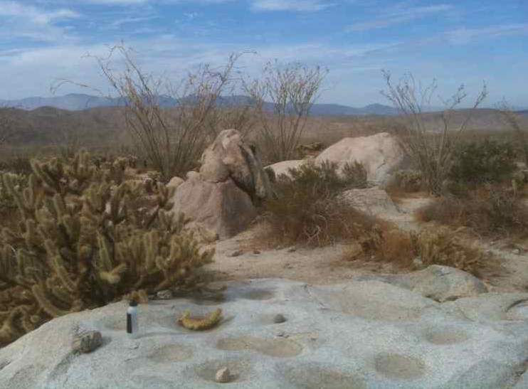
On a previous visit to Anza-Borrego desert, California, I found evidence that 'morteros' may have been more than merely grinding holes, but served as well as rocks capable of drawing ground moisture collecting inside the rock cavities drilled for that purpose. Lately, early October (2010) there had been some (barely measurable) rainfall in that part of the desert (about 0.01 inches), so thought to see what evidence I could find. I set out for a remote valley marked on the topographical map, where there is a kind of 'horseshoe' canyon at the base of a large mountain, opposite the other Pictograph rock, to see if there were any morteros there. In fact, I could not find any, but along the hike I did find some morteros with water in them, though the amount of recent rainfall was negligible. Why was that? Not all rocks with morteros had water in them; the shallow drilled ones did not, for example (see picture with hat of hollowed rock) at bottom of series, which again was totally dry; but when I tested the soil less than an inch down where there were filled 'water holes', it was dark with moisture. This lends credence that some rocks have the ability to gather up ground moisture, probably through capillary action, so water pools inside these deeper mortero holes. (The three morteros at the foot of other Pictograph rock, only one had water, the deeper one, while the two shallower ones were bone dry.) I had passed on the way the 'mortero' of a large rock at the foot of the mountain described in my earlier in-situ investigation (when I first tried to decipher the Pictograph tableau), and found some water in that rock, it sits opposite at where the rock fall leads up to a small valley half way up the mountain (where I surmised Kumeyyay might have plantings there, good moisture); so the soil there was also quite moist, probably due to the subterranean water coming down that rock fall. So it seems reasonable to surmise that either knowingly or not, the ancient Kumeyaay gathered ground moisture in these hollowed out morteros, where appropriate, pooling in sufficient quantities to be usable by them. This is really interesting, because for years I had puzzled over the Kumeyaay winter migration water source, but no streams or natural springs were visible where these desert dwelling clans had cave-like rock-shelter habitations (see picture). But could these ancient cave-dwelling desert clans have another water source, one that now makes sense if ground moisture can be gathered through (perhaps not consciously understood by them) by rock capillary action? (These water-morteros were ONLY at the base of desert mountains where moisture pooled below ground, so hydraulic pressure down mountain works to 'push' water up into the porous rock cavities.)
On previous visits I had found what appeared to be low fired pottery shards (left in-situ) at both Mine Wash road site and the Morteros site in Blair Valley. These were typically grey in color, fairly thin walled, and unglazed. I had also seen rock-art representations of pots (lower right in second image) at Morteros, which look like flat topped figure eights. Could these been used to gather water as well? To my modern mind, this is easily tested by simply burying a (porous) low fired pot into the soil at sites where ground moisture gathers, to see if it fills naturally. If it does, then this could be another example of how the ancient Kumeyaay collected water during their winter migrations to the desert. The advantage to this technique is it is also 'portable', so it can be employed at sites where they had their planting fields, such as up the small valley, or at the 'horse shoe' valley near the other leaning Pictograph rock. So now, no matter how large the clan in attendance, there can be enough water for all! And that is very exciting. Of course, to prove this hypothesis we would have to find buried pots in those planting areas, which to my knowledge no one had ever looked for such.
Anyway, these may be casual ramblings of a desert explorer who spent too much time in the sun, but this last trip was a very comfortable one, not too hot and made more pleasant by a light breeze. Also saw a meter long snake sleeping casually on the trail descending from the upper valley, on the way back to the car park; or was it playing 'possum? Either way, I left it undisturbed and admired its desert survivability, a symbol of rain and water so often represented on Kumeyaay rock-art paintings, worthy of being worshipped by those who survived alongside. |
Awe inspiring Anza-Borrego
| | Posted on Thursday, May 28, 2009 - 01:33 pm: | |
Some more pix of Anthony and me at Anza-Borrego desert Kumeyaay sites.
Anthony at Pictograph Rock (see post above)
Possible 'setting sun' calendar? - it catches western shadow of another boulder
Scalloping on large boulder at Morteros - sunrise calendar theorized by Anthony
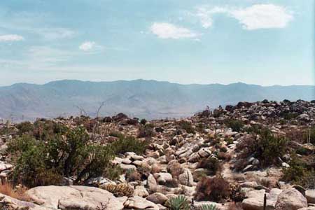
Desert scenery at Anza-Borrego
Desert traveler at home, a perfect day
This may be a 'yoni' rock, perhaps worshipped?
Getting ready to ride home, 4WD Hybrid still too hot
It was truly a spectacular day to explore, communing with the desert spirits of the ancient Kumeyaay. That they survived this hard land is commendable to their desert skills, though perhaps times were wetter centuries ago. It would be very hard today, though the information they left behind in their rock art would have helped. Still, they were a hardy lot to winter here, summer up in the mountains, a free life but also hard. A great day for us, truly awe inspiring to be there.
The 'real story', however, is really (7)all about water, and desert survival... or was it really about 'puberty rites' after all? |
Ivan/Morteros water
| | Posted on Tuesday, January 26, 2010 - 02:09 pm: | |
Looking for water in all the wrong places.
Looking for water in Anza Borrego desert is sometimes like looking for water on Mars. It's there alright, but not easy. Often, it runs beneath the ground, leaving stains on rocks and soil, only to seep up in strange places, like inside the rocks!
This last research hike into the desert, after a series of substantial rains, last of which was three days ago, was primarily to establish how much water was present in the little 'hidden' valley above the Blair Valley in Anza Borrego. This was earlier analyzed as it applied to interpreting Pictograph Rock's instructions on where it should be present. I had written about it here: http://www.humancafe.com/discus/messages/6/41.html#POST3974 , when first looked at rock picts, and also later here: http://www.humancafe.com/discus/messages/6/41.html#POST3981 , where the symbols were decoded.
Later, my friend Anthony and I returned to explore some more, here: (6)http://www.humancafe.com/discus/messages/6/41.html#POST5284 , where we went back to the Morteros site where there might have been a Kumeyaay rock calendar. At that same site were some mortero holes, dry when there last, but now filled with water. What made it puzzling, however, is that not all the holes had water, and some were bone dry. My first thought was that they 'emptied' out through cracks, but that did not seem to be apparent. Rather, it seemed that some had already evaporated (it hadn't rained for three days, hot sun), while others were 'replenishing' themselves, so were full with water.
Here are some pictures to show what it looked like this time around. No, I did not refill them from my water bottle!
At Morteros site, very deep holes with water
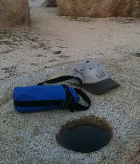
At Moreteros site, opposite 'calendar' rock (bottle shown for size only)

At 'hidden' valley, base of mountain opposite the trail (exactly 100 paces from Pictograph rock**, as per picts deciphered) - this was the mortero hole that gave me the first clue on my last visit, because while other morteros were dry, this one remained wet even during the dry season, which made me think: it is at the bottom of the rock fall where seasonal water should flow... hmmm... the soil is usually more wet there. Today, this mortero was very full. (I should add that these water-morteros are ALL at the base of desert mountains, which means natural hydraulic pressure would push up water into porous rock cavities.)
This made the trip all the more interesting, that the Indian tribes that used the desert for winter habitat had a secure water source, if their morteros were able to 'suck up' the ground water into the holes carved. So morteros may have served a dual purpose, one to use as grinding holes, or metates, and the other as a source of water, refillable after each use during the wet winter season. However, what may be most remarkable, and why some morteros are shallow while others deep, is that the shallow ones were mainly for grinding, only incidentally gathering water from rain, which quickly evaporated; while the deeper holes were primarily for water absorption, which allowed the porous rock to refill the holes through a natural process of capillary action. This latter use is yet unconfirmed, but it makes for an interesting hypothesis: Indians carved 'deeper' holes where there was evidence of such capillary action water retention, but shallower holes for grinding where no such absorption occurred. (Which makes sense. After all, who wants to grind stuff in a hard to retrieve deep hole anyway?) The Kumeyaay have proved in the past to be imminently practical people who knew how to survive in this hard desert, and part of that practicality was economy of effort. So why dig a deep hole, when a shallow one will suffice, unless the deep hole serves another purpose? (See "Afterthoughts" in post below for more info.)
Other than occasional temporary muddy puddles, the desert is not generous with its water. But deep inside these morteros the water was clear and replenishable. That is a find! And it most probably explains how they could survive in the desert without apparent flowing water. After each use, the water gradually filtered back into the hole, and was ready again for use.
As the moon rose over the valley desert ridge
Otherwise, it was a beautiful day to be out there, sunny mid 60s, a lovely day to hike. Only met some hikers from Wisconsin, all alone otherwise. I did climb the little patch of valley half way up the mountain as depicted in Pictograph Rock to look for flowing water, but only found heavy ground moisture where crops could have been planted during the wet winter season, and evidence of recent water flows, but none today. Put a finger in the soil, and it comes out wet. If I were Kumeyaay, I'd plant squash and corn upon arrival in Fall, and watch them grow during the wet season, to be harvested before Spring migration back up the mountains. Hard work, but it's a living.
|
Kumeyaay 'watering holes'
| | Posted on Wednesday, August 04, 2010 - 10:47 pm: | |
Some new observations on ancient Indian 'watering holes' of the Kumeyaay in Anza-Borrego desert.
On my last visit to a Kumeyaay site in Anza-Borrego desert, where they wintered in ancient times, gave a new clue on 'watering holes' the Indian used during their stay to survive in between rains.
The old village was at the bottom of a large hillside on Mine Wash road, 1.6 miles south of CA78, where numerous 'morteros' were found. An abundance of other artifacts, especially flint flakes, discarded broken arrowheads, and pottery shards attest to their presence here, perhaps for centuries or millennia. The idea of mortero holes dug out in large rocks might have served as a source of water had been explored here earlier: http://www.humancafe.com/discus/messages/6/41.html#POST5412 for past visit to similar Kumeyaay sites.
Mortero 'watering holes' at Mine Wash road site
Though not corroborated in any archeology publications, this idea now seems more likely, as new observations show. All morteros were on large flat stones in the sand, none were evident on similar stones higher up the mountain. This would make sense if these holes were dug in rock porous enough to absorb the underground moisture accumulated from run offs from the mountain, where such water (through capillary action) would refill the mortero holes. So in addition to an incidental use as 'metate' holes used for grinding foodstuff, such as seeds or acorns, the real underlying purpose may have been to gather underground rain water.
Example of rock 'shelters' found higher up the hill
In following what appeared to be natural paths, some of which had been augmented with large boulders to create a crude 'staircase' up the hill (climbing these large boulders is otherwise difficult, and dangerous), I was able to locate a number of such shelters, though I had not seen them on earlier explorations. I was looking for two caves in particular seen on past visits, one of which I found (though the entrance was now partially blocked by fallen rock), but not the other, though I found one site that might have been it, now caved in with the large boulder collapsed into the former cavity. This part of southern California is geologically active with daily quakes, most small, so such movements up the mountain would not be unexpected. However, in the years coming here, I never expected the site to change so quickly. Nevertheless, following natural cleared footpaths led me to find more of such 'caves'. Mostly they were shallow, enough to sit inside comfortably, but may have been backfilled with sand over the years. The Indians would have dug out the sand from under large propped boulders, and found easy cover from the elements, including the hot sun, or rain storms. Finding such shelters had been something of a joy for me, because it made me feel closer to the Kumeyaay of old, though they may have built rough shelters as well, provided vegetation materials were available. The simplest solution was to excavate shelters from boulders already there.
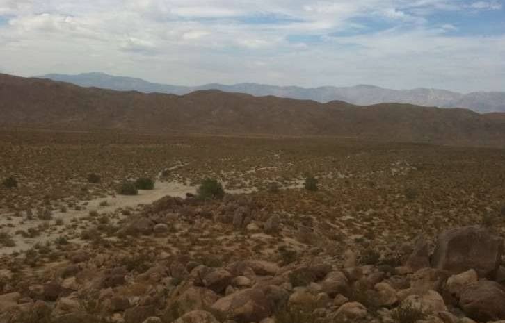
High vantage point looking north, with my black hybrid auto showing as a dot left of the large tree, central left in pict
From such a high vantage point, it would be easy to spot game in the distance. There is an abundance of desert hares, also some big horn sheep (I could smell goat up the hill, but did not see any), as well as coyotes, lynx (had found half buried scat), and an assortment of chipmunks scurrying about, as well as lizards, birds (including partridge, crows, hawks), and surprisingly, bees. These bees took a persistent interest in my perspiring skin, kept landing on me, sometimes several at a time, but did not sting. They appeared not to be threatened by my presence, and really wanted the moisture and salt. (I gave them some water in a mortero, but they liked me better!) Never got stung, even when I waved them away with my hat, which made me appreciate them for also being desert survivors, like those ancient Indians.m In the desert, water is life.
So, were the mortero holes 'watering holes'? Very possibly, since they only sit at the base of the mountain on the ground, none were found higher up the hill. This, as per the previous article, would lead to the conclusion that such morteros were indeed to gather moisture from the soil, as past visits had shown.
The Kumeyaay were smart desert survivors.
Also see Pictograph Rock for interpretation of what was the message for travelers passing by:
http://www.humancafe.com/discus/messages/6/41.html#POST3974 (scroll down for more pictographs)
http://www.humancafe.com/discus/messages/6/41.html#POST3981 (in situ investigation)
http://www.humancafe.com/discus/messages/6/41.html#POST5284 (possible calendar)
http://www.humancafe.com/discus/messages/6/41.html#POST3989 (red 'flags' in the desert)
http://www.humancafe.com/discus/messages/88/446.html#POST4912 (second less well known pictograph rock)
I should explore the other valley of lesser known pictograph rock for possible 'watering hole' morteros there.
_______________________________________________________________________________________
Some afterthoughts on Kumeyaay 'watering holes', following a subsequent in-situ investigation: Was pottery buried to collect ground moisture?
On a previous visit to Anza-Borrego desert, California, I found evidence that 'morteros' may have been more than merely grinding holes, but served as well as rocks capable of drawing ground moisture collecting inside the rock cavities drilled for that purpose. Lately, early October (2010) there had been some (barely measurable) rainfall in that part of the desert (about 0.01 inches), so thought to see what evidence I could find. I set out for a remote valley marked on the topographical map, where there is a kind of 'horseshoe' canyon at the base of a large mountain, opposite the other Pictograph rock, to see if there were any morteros there. In fact, I could not find any, but along the hike I did find some morteros with water in them, though the amount of recent rainfall was negligible. Why was that? Not all rocks with morteros had water in them; the shallow drilled ones did not, for example (see picture with hat of hollowed rock) at bottom of series, which again was totally dry; but when I tested the soil less than an inch down where there were filled 'water holes', it was dark with moisture. This lends credence that some rocks have the ability to gather up ground moisture, probably through capillary action, so water pools inside these deeper mortero holes. (The three morteros at the foot of other Pictograph rock, only one had water, the deeper one, while the two shallower ones were bone dry.) I had passed on the way the 'mortero' of a large rock at the foot of the mountain described in my earlier in-situ investigation (when I first tried to decipher the Pictograph tableau), and found abundant water in that rock, it sits opposite at where the rock fall leads up to a small valley half way up the mountain (where I surmised Kumeyyay might have plantings there, good moisture); so the soil there was also quite moist, probably due to the subterranean water coming down that rock fall. So it seems reasonable to surmise that either knowingly or not, the ancient Kumeyaay gathered ground moisture in these hollowed out morteros, where appropriate, pooling in sufficient quantities to be usable by them. This is really interesting, because for years I had puzzled over the Kumeyaay winter migration water source, but no streams or natural springs were visible where these desert dwelling clans had cave-like rock-shelter habitations (see picture, above). But could these ancient cave-dwelling desert clans have another water source, one that now makes sense if ground moisture can be gathered through (perhaps not consciously understood by them) by rock capillary action? (These water-morteros were ONLY at the base of desert mountains where moisture pooled below ground, so hydraulic pressure works to 'push' water into the porous rock cavities.)
On previous visits I had found what appeared to be low fired pottery shards (left in-situ) at both Mine Wash road site and the Morteros site in Blair Valley. These were typically grey in color, fairly thin walled, and unglazed. I had also seen rock-art representations of pots (lower right in second image) at Morteros, which look like flat topped figure eights. Could these been used to gather water as well? To my modern mind, this is easily tested by simply burying a (porous) low fired pot into the soil at sites where ground moisture gathers, to see if it fills naturally. If it does, then this could be another example of how the ancient Kumeyaay collected water during their winter migrations to the desert. The advantage to this technique is it is also 'portable', so it can be employed at sites where they had their planting fields, such as up the small valley, or at the 'horse shoe' valley near the other leaning Pictograph rock. So now, no matter how large the clan in attendance, there can be enough water for all! And that is very exciting. Of course, to prove this hypothesis we would have to find buried pots in those planting areas, which to my knowledge no one had ever looked for such.
Anyway, these may be casual ramblings of a desert explorer who spent too much time in the sun, but this last trip was a very comfortable one, not too hot and made more pleasant by a light breeze. Also saw a meter long snake sleeping casually on the trail descending from the upper valley, on the way back to the car park; or was it playing 'possum? Either way, I left it undisturbed and admired its desert survivability, a symbol of rain and water so often represented on Kumeyaay rock-art paintings, worthy of being worshipped by those who survived alongside.
|
Pumpkin Patch concretions at Anza-borrego
| | Posted on Thursday, June 23, 2011 - 04:09 pm: | |
Pumpkin Patch site and 'concretion' balls at Anza Borrego desert.
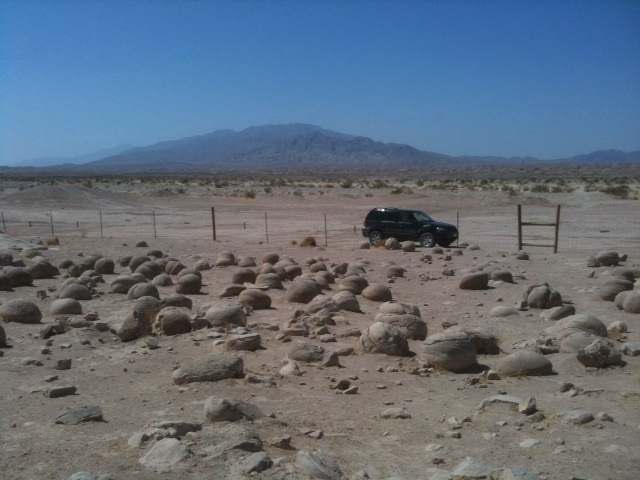
Pumpkin Patch 'concretions' field of stones
You know it's hot when your eyeballs feel they're cooking inside your head. That was what it felt like when I visited the Pumpkin Patch site of round stone formations in the Anza Borrego desert, southern California, on this hot June day. The road there, going East from Borrego Springs (about 10 miles), starting at S22, then down Arroyo Salado dirt track to 17 Palms, where 0.2 miles past turnoff is track to 5 Palms, then all the way down Tule Wash to Pumpkin Patch turn off on right. It's all a very rough, sandy and pitted dirt road, with sharp turns and rock cave-ins in places, so requires 4X4 wheels, but it is a beautiful place to visit. Along the way you're bound to see many jackrabbits, some other small ground chipmunks and desert mice, lizards, even occasional coyote, like the one I saw was juvenile and so skinny I left him a piece of my peanut butter sandwich, hope he finds it. One jackrabbit ran so fast on my approach that I swear his ears pulled back to his hind legs! Fascinating to see animals surviving such harsh desert conditions, but they're there. But no birds this time, maybe too hot?
[These are the best desert coordinates I could find on Google maps: N33 11.065 W116 05.128 - Zoom in (3 clicks) for Pumpkin Patch turn off, that roundish area I think is where the 'fenced off area' is for the round stones; this is outside Anza-Borrego State Park, in Ocotillo Wells off road recreation area, so protected from ATVs using the area.]
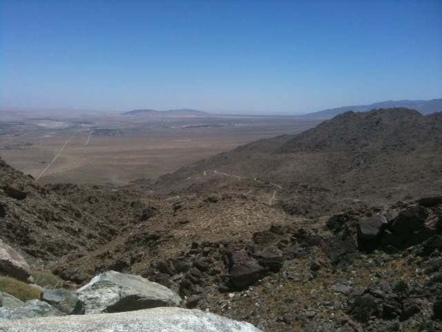
Looking down into the inferno, Borrego Springs, S22 down from Ranchita, CA
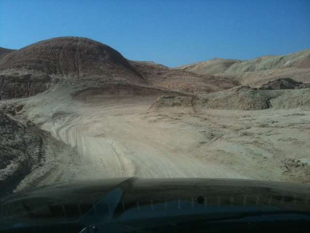
Sandy dirt track at 5 Palms
Pumpkin Patch field of stone
I had been looking for this dirt road to Pumpkin Patch for over an hour driving in rugged and at times dangerous conditions, since I had missed the 5 Palms turnoff, so had to double back. (While walking some distance from car to see if another road was there, I found an arrow head, so not total loss.) The reason for my persistence was because I wanted to see for myself what these desert sandstone 'concretions' were all about. The common accepted explanation is they 'concreted' into such large round balls due to sand collected around small bits of sea shells, though I find that incredulous. Why would they all be about the same size, for example? As the desert sands get blown away or washed out, these mysterious balls rise to the surface in what looks like a plain of car-wheel sized round stones. Upon examination closer, they are indeed 'concreted' in concentric spherical layers starting from a small nob inside. But was this really what happened?
Scientific explanation at Pumpkin Patch (none of split concretions I saw showed any fossil at their centers)
Round concretion by wheel
My idea is that these are actually fossilized 'stromatolites' , similar to those today found in Western Australia's shallow sea at Shark Bay. But most of such primitive bacterial colony formations are now gone. So what we find are fossilized remnants of life such as these 'concretions' which may very well be over a billion years old when the area was a shallow sea of the Precambrian period. If other fossil evidence is to be believed, these stones may be close to 2 billion years old, which would put them into the Paleoproterozoic period. Another example of such stone fossil formations may be the Navajo Moqui Balls, though much smaller. (I bought a moqui ball at a rock shop in Holbrook, AZ, when passing through there.) But such an explanation would need confirmation from close microscopic analysis of these stone concretions for evidence of bacterial colonies, if they are related to what we see at Shark Bay today. Of course, they could be much more recent from the Paleozoic rocks of the Devonian period (600-400 million years ago) when much of the southwestern part of North America was a shallow sea. Or more recent still from the Septarian concretions period, about 70 million years ago. Detailed microscopic analysis would be needed to narrow it down.
 (interactive - great underwater video embedded) (interactive - great underwater video embedded)
Shark Bay modern stromatolites (click image) western Australia
My moqui marble on large stones, Pumpkin Patch
Concentric interior of concretions
When the shallow seas retreated, from whatever period, these bacterial colonies fossilized, mineralized in the sands where they remained as fields of large round stone fossils where they lay. I think this is a better explanation than presented at the site. More study is needed of these fascination concretion stone deposits, as these round stones may be our most ancient 'ancestors' on Earth. Pumplin Patch fossilized bacterial accretions is not so far fetched. Fossilized ancient bacteria enclosed in glassy crust coated silica is preserved in 3.4 billion years old sandstone: Oldest reliable fossils show early life was a beach - (NewScientist, August 2011)
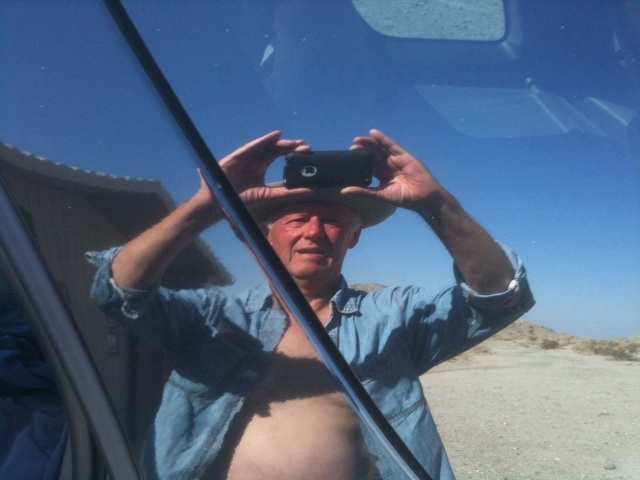
It was hot!
Desert life savers
In any case, for anyone who wants to visit this hard to reach site, bring lots of water, warm clothing for evening, four wheel drive automobile with good clearance, a cell phone (works in places) and extra food. You just never know, better be prepared, but well worth the effort.
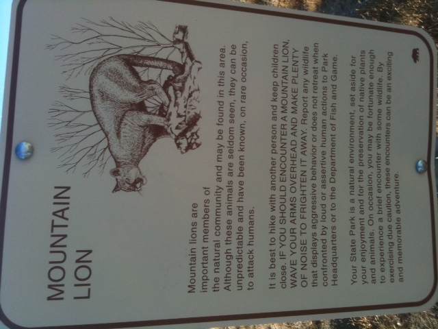
Warning sign: Mountain lions... never saw one
Ivan |
Desert Solitaire pix
| | Posted on Thursday, April 26, 2012 - 03:18 pm: | |
'Desert Solitaire' in pictures.
Late April can be a beautiful time in the desert. Winter rains had brought out desert wildflowers, and wherever you look you find them in bloom. Though this year was sparse on rain in the Anza-Borrego desert, there were flowers, though some were in miniature (like above). That's what I spent the day doing, though cloudy skies threatened rain, on a hardy hike in the Upper Little Blair Valley near Pictograph Rock. Some pictures I took (on iPhone 3GS) are shown here:
 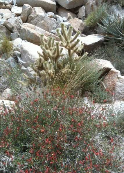
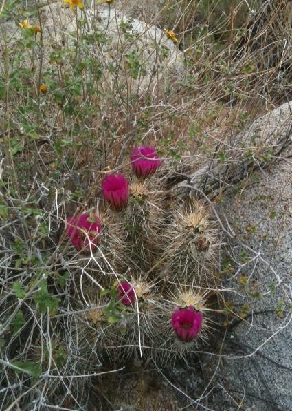 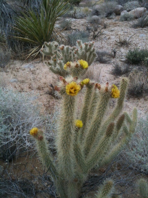
 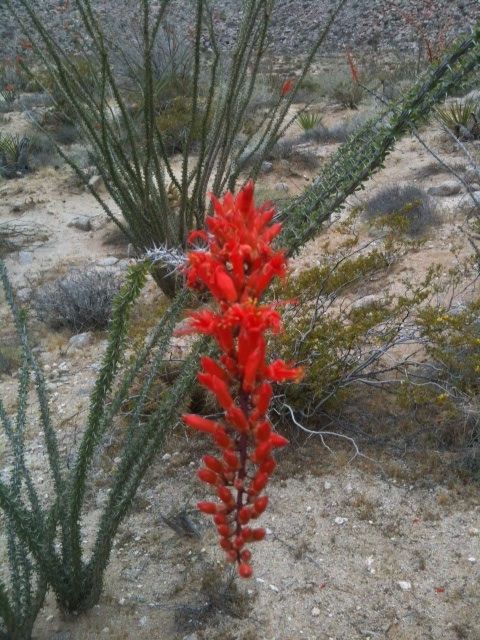
 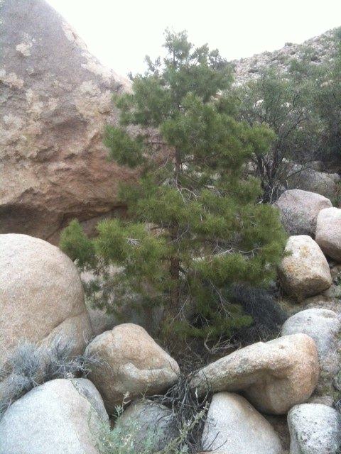
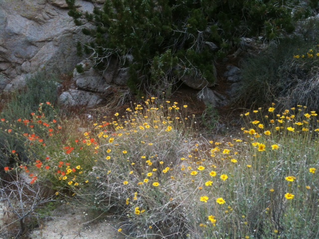 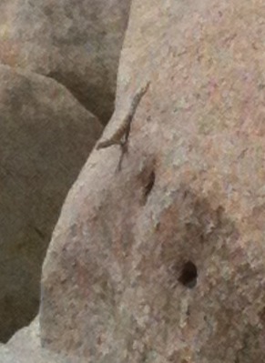
I was surprised to find a rare desert conifer (above) at bottom of large drain from mountain above, but obviously it found water to root. But this was not the only surprise of the day. In my hiking an obscure trail in little visited northern part of the Upper Little Blair valley, I came across other curiosities, as nature can be her own sculptress.
 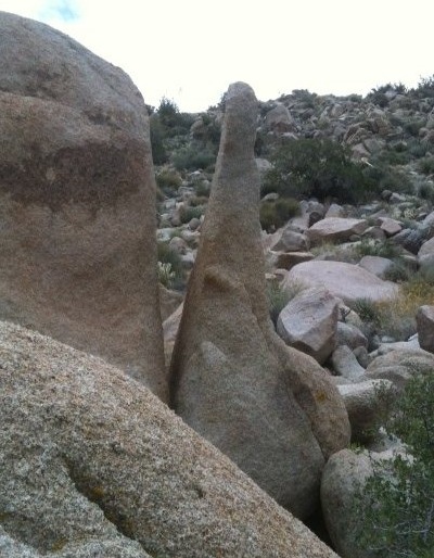
Was that a desert 'nude', or a natural 'stone lingam'? In fact, the tall upright stone had an ancient path climbing up (bears left above stone marked trailhead) from the desert floor. Did ancient Indians venerate it, perhaps?
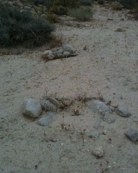
The long abandoned fire-pits had no modern debris, not even old rusted cans, but looked very weather worn. Could they have been Indian? There were other stone flakes nearby too, including some small, broken sun bleached bones, likely bird's.
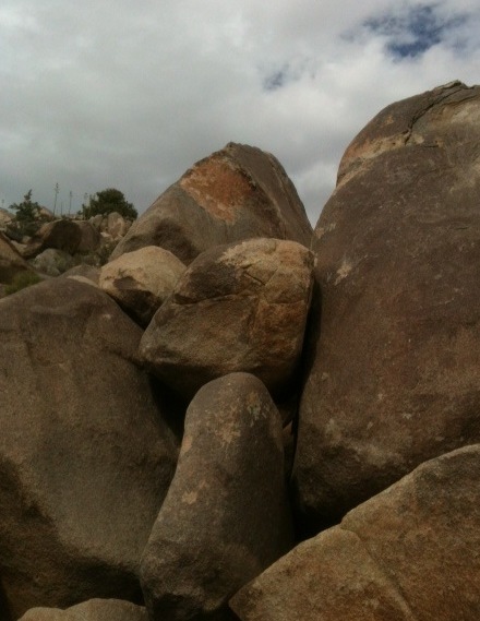 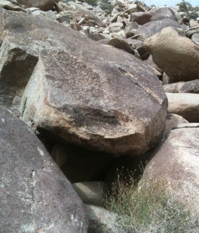
At another remote part of the northern valley, where I thought Pictograph Rock 2 alluded to ancient planting fields, I saw this (apparently) hand chiseled 'red flag' atop a large boulder, with some rock shelters bellow, similar to those I had found earlier elsewhere. ('Red flags' usually signaled something of importance nearby, like water-morteros, or rock shelters.)
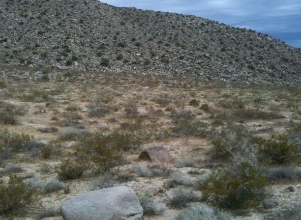 � Ancient planting fields here? Still no real evidence, no pottery shards. � Ancient planting fields here? Still no real evidence, no pottery shards.
Ancient Kumeyaay Indians may have been obsessed with finding suitable arable land in the desert, so to sustain them with legumes and vegetables through the winter. No doubt, they planted corn and beans, or squash, up the mountains during their summer stays there, but the desert posed another challenge. Not enough water. Picking wild berries and nuts would not have sustained them sufficiently, even with plentiful small game.
 
At the southernmost end of Upper Little Blair valley is a sharp cliff drop-off into the valley below, obviously carved from thousands of years of flowing water, where it dropped off in a sheer cascade (very dangerous to venture too close to its edge!); and just before entering the gorge where is this drop stand some large boulders (on right), one of which seems to show a very faded red marking on it. It looks like the sun, though it faces due north. Significant, or mirage? I found a similar marking just opposite on side of long valley from where is Pictograph Rock, which may have been alerting ancient travelers to look around. Just above Pictograph Rock is a large 'red flag' easily seen from this spot. Related?
There was also, on this relatively comfortable cloudy day, a fair amount of wildlife. At these sites I saw birds, crows and song birds (maybe a humming bird buzzed me too), a variety of insects, including bees, and at least three small dark grey squirrels with bushy tails, a number of chipmunks, lizards, and jackrabbits. No coyotes this time, and no snakes either. But recent rains, scant that they were, offered a meager existence for a number of critters there.
On the drive back home I paused for this 'Ansel Adams' picture over a ranch at Warner Springs, CA.
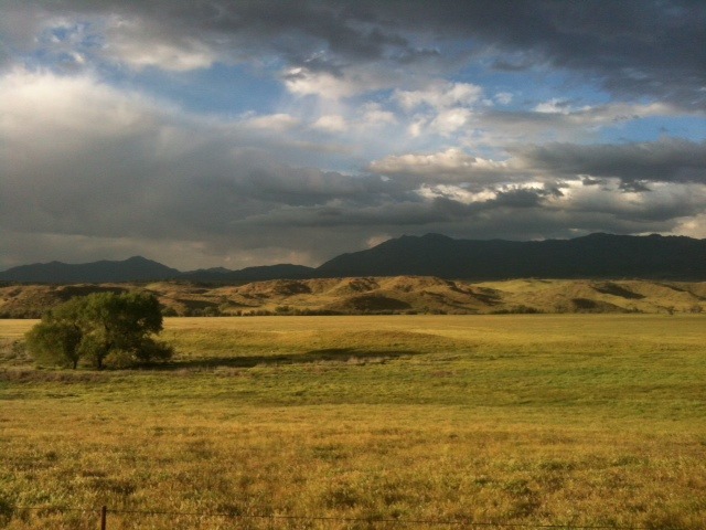 Further down the road there were cattle grazing, it was a bucolic scene. Further down the road there were cattle grazing, it was a bucolic scene.
It was a good desert day.
[Note: Always bring plenty of water on desert hikes, and energy boost snacks to sustain you, as hiking in rough terrain, maneuvering cacti barbs, and spending hours under the sun can do you in. Be safe, and wear good shoes.] |
Calcite Mine in Anza-Borrego
| | Posted on Friday, June 15, 2012 - 12:50 am: | |
The Calcite Mine at Anza-Borrego Desert, California
It was a hot, dazzling blue sky day in the desert, temps hovering at 38C/100F, and though the climb was grueling, I was determined to get there and see the Calcite Mine. But it took a hike.
Taking S22 East from Borrego-Springs roundabout, go nearly 20 miles until the Calcite Mine turn off on the left, a park tableau stands there. Then very cautiously negotiate the rough stone road down into the ravine and up again, going about 2 to 2.5 miles until you reach a sort of overlook and VERY CAREFULLY turn around and park there (it took me six nerve racking points to turn around here, very narrow space). By the side of the road is a sheer drop of couple of hundred feet, so don't mess up, and don't misstep. It would be fatal. (This is important: park pointing down first, because by the time you return you may be too exhausted to do it safely.) The road beyond here is too rough for normal vehicles, including 4X4s unless you have very large wheels and high clearance. My little Ford Escape Hybrid 4WD had the heart, but not the clearance. The rest of it, nearly 2 more miles, you have to do on foot.
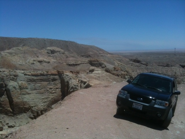
Parked at side of deep ravine (there is an easier, less dangerous turn-around point down the hill a few dozen yards back, on the flat in arroyo)
Deep chasm next to parked car, couldn't see bottom
The rest of the very rough road is mostly uphill, with little shade, so be prepared and have lots of water and snacks to keep up your energy. On a hot day like this, stop to rest, or you will feel faint from the climb, like I did. You follow that road up until you see the Calcite Mine Area sign, and then go up some more. Turning left at the top of the hill you'll see two long narrow channels the miners dug out, and to the right a very long one up a cliff, where they were looking for this very high quality calcite. (When polished, calcite has special optical properties - birefringence - that splits light, so why used in WW II bombadier target sighting, and why the mine was commissioned by the US Government.) The views from this hike are spectacular, and at times beyond the dark, desert varnished rocks you'll see Salton Sea hazy in the distance. The day I was there I encountered not a soul, nor man nor beast, not even birds, except one lost bee. It was also Martian dry, even plants looked sun bleached. The desert vastness and silence was like a buzzing in my ears. Stark beauty all around.
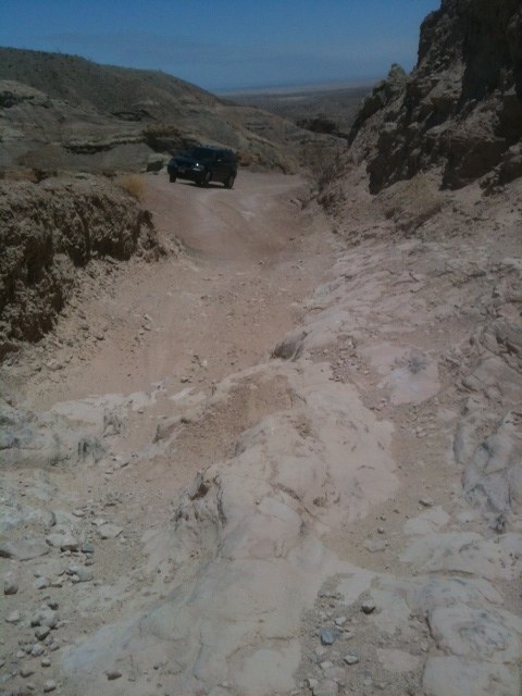
Very rough road beyond this point
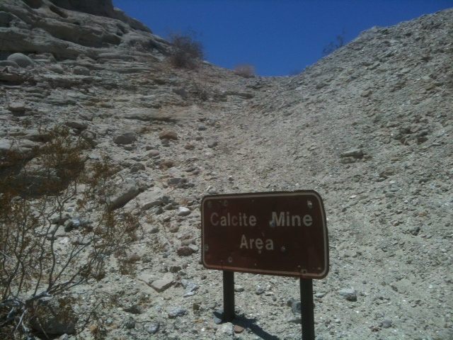
Calcite Mine sign, you are almost there
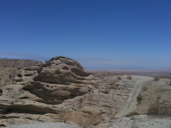
Jabba the Hutt large rock near top, small road leads East, Salton Sea in distance at right of rock
Now that you've arrived in the area, climb to the top of the hill and start looking around. You'll see lots of sparkling little shards of calcite litter everywhere, and once you locate the vertical mine shafts, you'll still find some calcite veins embedded in the rocky sides.
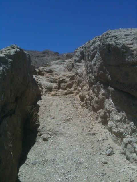 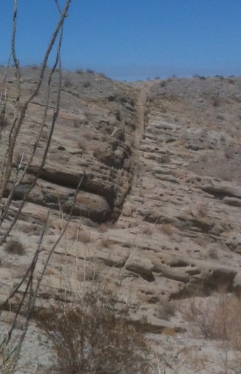
Vertical cut mine shafts, a long shaft cut up the side of mountain
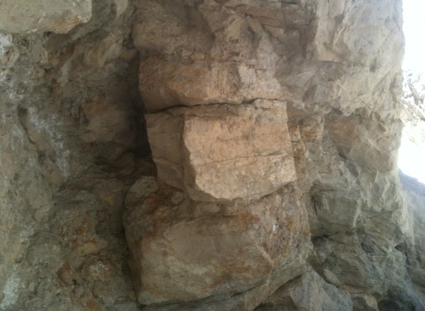
Embedded calcite veins in shaft
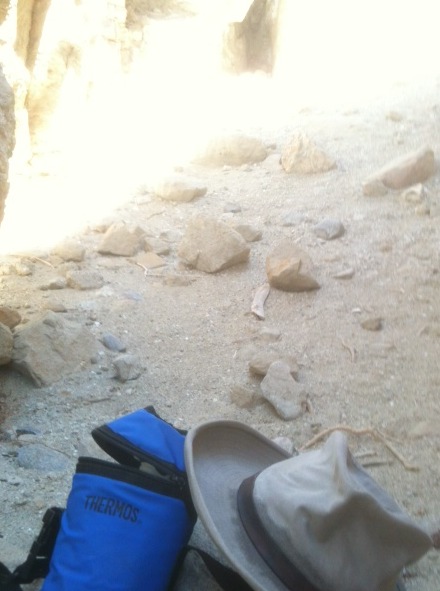 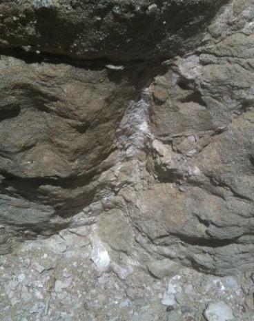
From inside vertical shaft (not dangerous), and more calcite veins
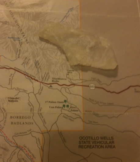
Calcite shard found at the site, about 7 cm/3 in.
After running around, or more like stumbling atop, the hike back is easy, mostly downhill. Though, now that I knew what to look for, I started finding more evidence of mining on the road back, something I overlooked on the way up.
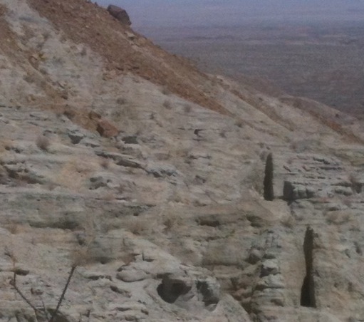
More vertical cut shafts along the road back
All in all, despite the tired legs and light headedness from the heat, it was a beautiful day and most enjoyable discovery. But, except for some old big tire tracks and hikers' shoeprints, I did not see another soul, really. The mine was all mine!
Always dress properly, good shoes and hat a must, and have adequate supply of water. |
Bombay Beach & Salton Sea
| | Posted on Thursday, July 05, 2012 - 02:11 pm: | |
Images from Salton Sea and Bombay Beach, California, on the 4th of July.
It was a clear sunny day, hot 101F/38C, but not uncomfortable in dry desert air. The sea looked beautiful, though it had a faint smell of 'cow manure'. But the bird life, shy of humans, didn't mind it much, especially pelicans and blue herons. Here are some pix:
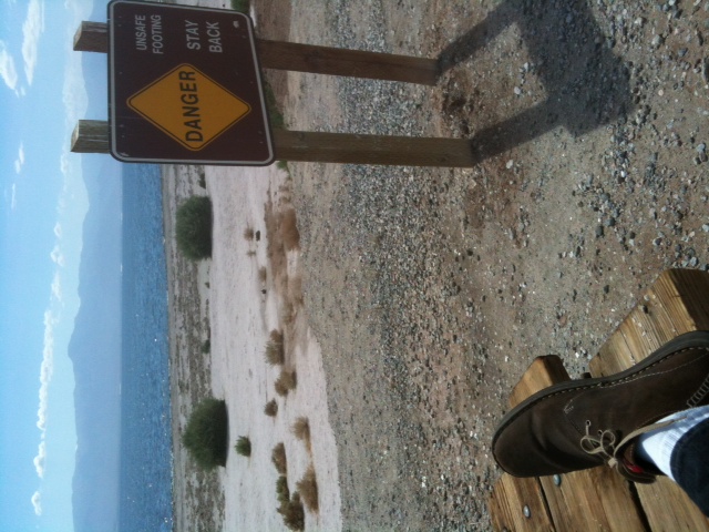
Desert boot at Salton Sea beach, beach closed and abandoned
Dead Tilapia on shore, everywhere
Salton Sea with birds, shy of humans
Union Pacific rail car idled at Bombay Beach, sideline track
Train rolling by over Bombay Beach, 4th of July
Local watering hole in Bombay Beach, good cold beer
Leaving Bombay Beach, Chocolate Mountains in background
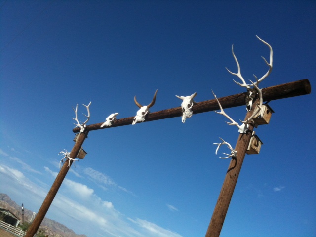
Desert wild West, at Hot Springs south of Bombay Beach
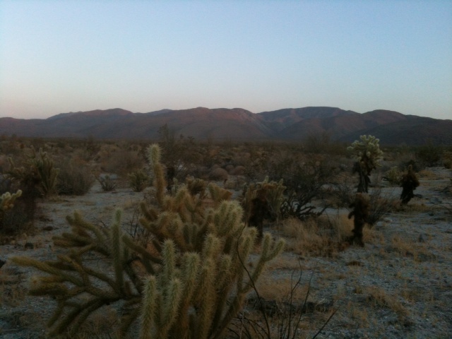
Sunset over Anza-Borrego desert on way back home
The Fourth of July for most people is picnics with hot dogs and potato salad, followed by loud fireworks. But to spend the Fourth in the vast quiet solitude of great desert panoramic vistas is another way to honor the precious Liberty our nation's Founding Fathers envisioned two and a half centuries ago, and it gladdens the heart. Thanks to them we have these beautiful deserts to cherish and explore, and to preserve for all future generations.
God Bless America!
 |
Mine Wash India site revisited
| | Posted on Sunday, August 14, 2016 - 01:57 pm: | |
Mine Wash road Kumeyaay Indian site revisited.
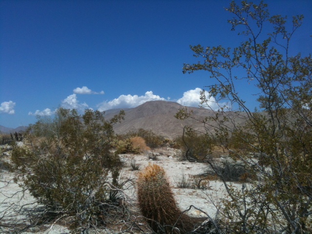
A perfect day, but hot
This is a continuation of 'Watering holes' of Kumeyaay village in Anza-Borrego desert.
It was the time of the shooting stars of Perseid showers, clear blue skies, some white clouds, hot (106F/41C), a light breeze made it a perfect day to revisit an earlier search for water in the winter camp of the Kumeyaay. In fact it had rained some about four days earlier, but no flowers, the desert wrapped in a four year drought of Southern California. Very little animal life, some lizards, a couple of birds, chipmunks scurrying, but it looked mostly dry and dead. The Indians of Anza-Borrego lived here only in winter, when water was present in the ground and could percolate up through porous rocks at base of a mountain. That was discovered earlier, that winter time found these large 'morteros' filled with water. Now they were dry, except for moisture in one mortero hole at the Mine Wash site. But all others were predictably dry.
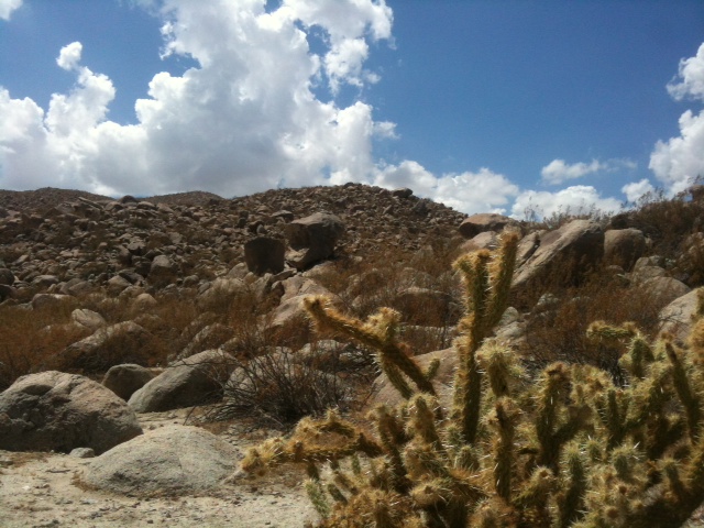
Boulders up the hill, followed faint foot trails to rock shelters above
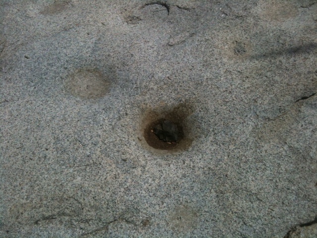
Dark moisture stain in mortero hole
The goal of this visit was to see up the hills what were stone shelters used by the Indians in their winter camp. Typically, they excavated soil and rocks from under large boulders to create a livable cavity for two or three people, a place to rest from the sun and shelter from wind and rain. These large stones offered a cool place during the day, but radiated warmth from accumulated sunshine at night, so they were natural shelters, or caves.
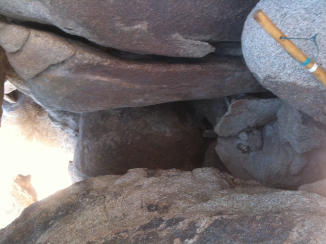
Under boulder 'cave'
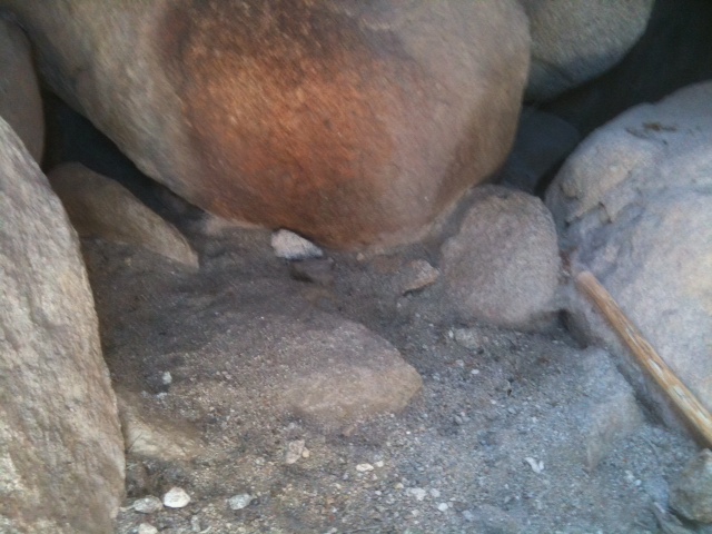
Big enough to sit inside, possible ancient cooking fire stain
Following what appeared to be ancient trails, though now often overgrown with recent vegetation, bushes or cacti, it was possible to retrace the steps of the Indians from shelter to shelter up the rocks. Some was hard climbing, especially in summer heat, but not too difficult if strong and in good physical shape. The Kumeyaay lived on hunted game and various harvested seeds, including chia, so they no doubt were lean and fit for this hard landscape of boulders, climbing them like mountain goats. In fact, big horn sheep was likely their prime game, as they would feed a clan aplenty. At another site further down Mine Wash, where I made camp under a large stone offering shade, there were many big horn droppings, some dry but others still fresh.
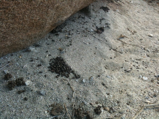
Big horn sheep droppings

Small campfire, wood from home
I needed protein to sustain hike. Big horn steak would have been better, but grilled hot dog was okay. Bring lots of water.
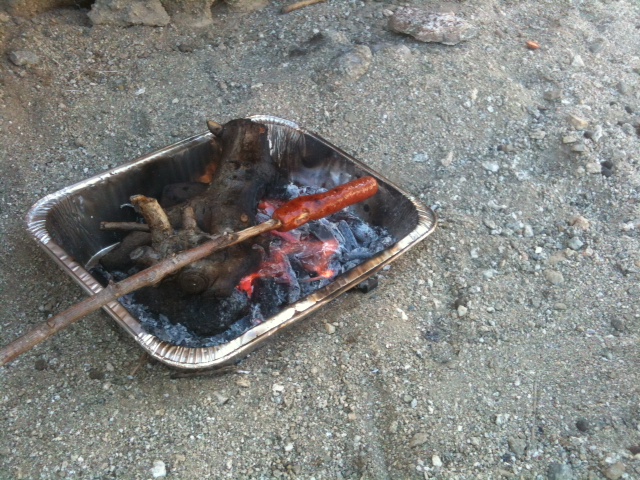
Lunch, only fire in metal containers allowed
It was perfect solitude, not a single person or car the whole day. Just nature and open spaces, silence and the sound of ones footsteps.
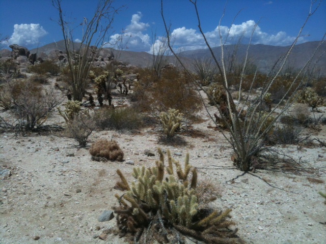
Desert 'green'

Cholla cactus
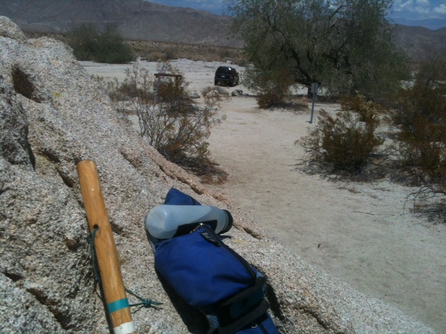
All alone in the desert
IDA
humancafe@aol.com
Also see: Kumeyaay tool making factory |
Ivan Alexander
Username: Humancafe
Registered: 12-2017
| | Posted on Friday, May 11, 2018 - 09:44 pm: | |
More Mine Wash road, Anza Borrego desert pictures.
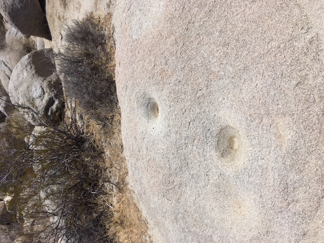
Morteros doubling as water cups
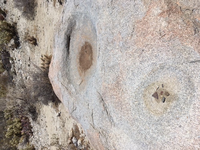
More morteros with water stains & flakes
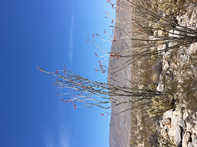
Ocotillo with some flowers
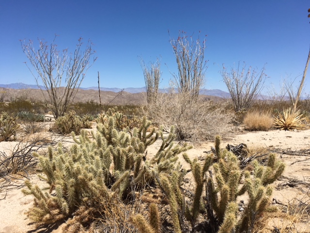
Desert vast stillness
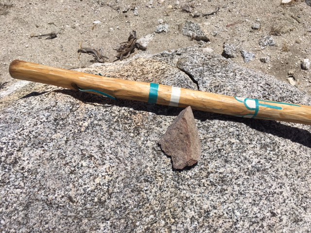
Maybe spear point
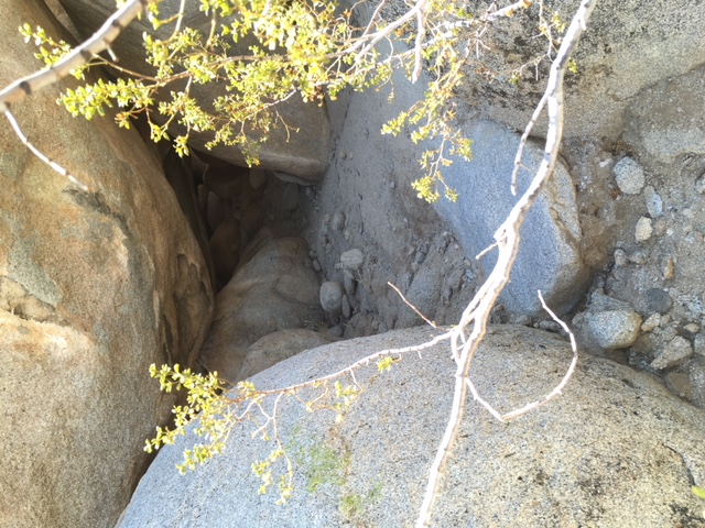
Long �cave� shelters under boulders
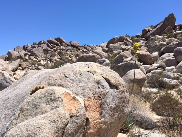
Red flags near �caves�
Gotta eat, Happy desert man
IDA |
Ivan Alexander
Username: Humancafe
Registered: 12-2017
| | Posted on Thursday, June 13, 2024 - 02:05 pm: | |
Gold in the Anza Borrego desert, maybe.
Well, there may or may not be gold lying around in Anza Borrego desert, but according to this story, Pegleg Smith's Gold Nuggets � Real or Imaginary?, there were black gold nuggets he found atop a butte in Anza Borrego. On my recent day trip to the area where Pegleg allegedly found the nuggets, I didn't find any gold lying around, though at bottom of a mesa I did find suspicious gold flakes glowing in the sand, which I assumed are mica flakes, alas. But it was a fun day, not too hot, 95-100F, dry, sunny blue skies, and didn't meet another soul while there except for a couple of ranchers' pickup trucks in the distance. (More on Anza Borrego gold: Pegleg's Gold Found? - Black Gold Nuggets)
My visit was actually to Rockhouse Truck Road, which is east of Borrego Springs off S22, which is a short drive from the town's traffic circle to the trail turn off, about 6.7 miles.
After turn off the pavement ends and a hard packed dirt and rock road continues through a large dry lake bed until you reach a tall standing stone that marks the location of a prospector's rock house just beyond.
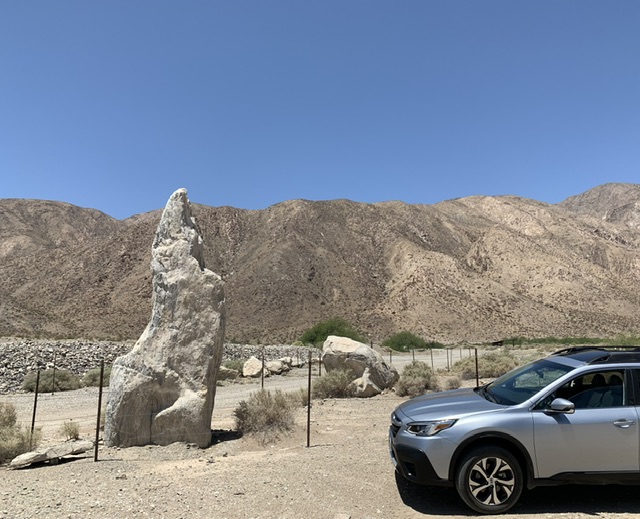
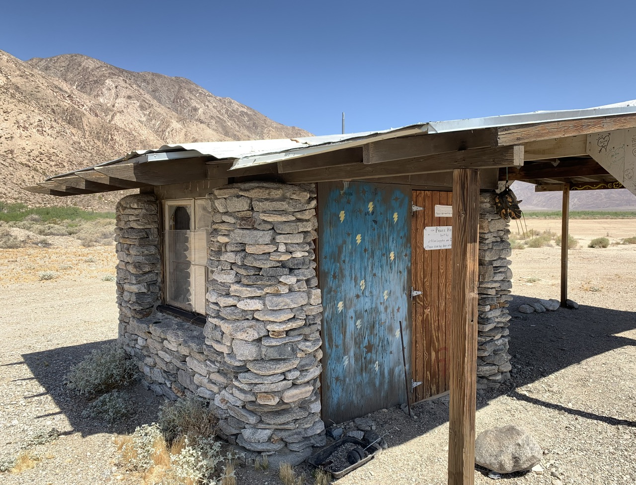
Allegedly this was a rock house used by miners, though it is small, could sleep two or three, and now had been creatively restored into what looks like a nice desert retreat with stone heart outside.
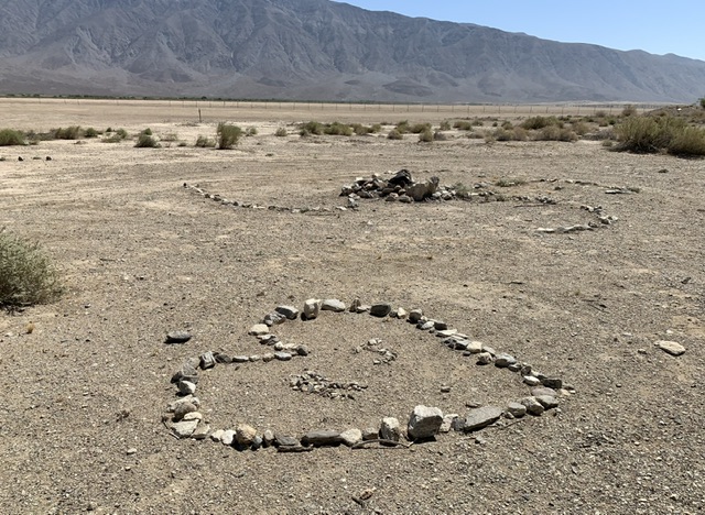
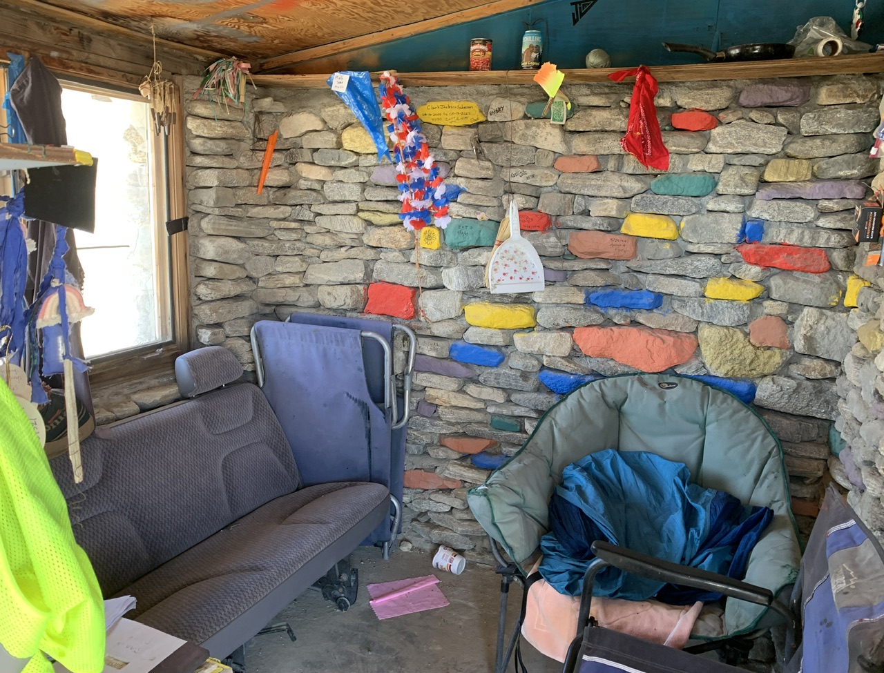
The interior has been eclectically furnished, like a hippie retreat, with a guest book signed by visitors over the years. (The hand done sign on the door shows Alan Leppke and Dudley Clark had built it.) Just beyond the rockhouse the desert trail continues but there it gets harder to manage, bigger rocks and soft sand, so would recommend four wheel drive to continue there. My Outback handled it fine.
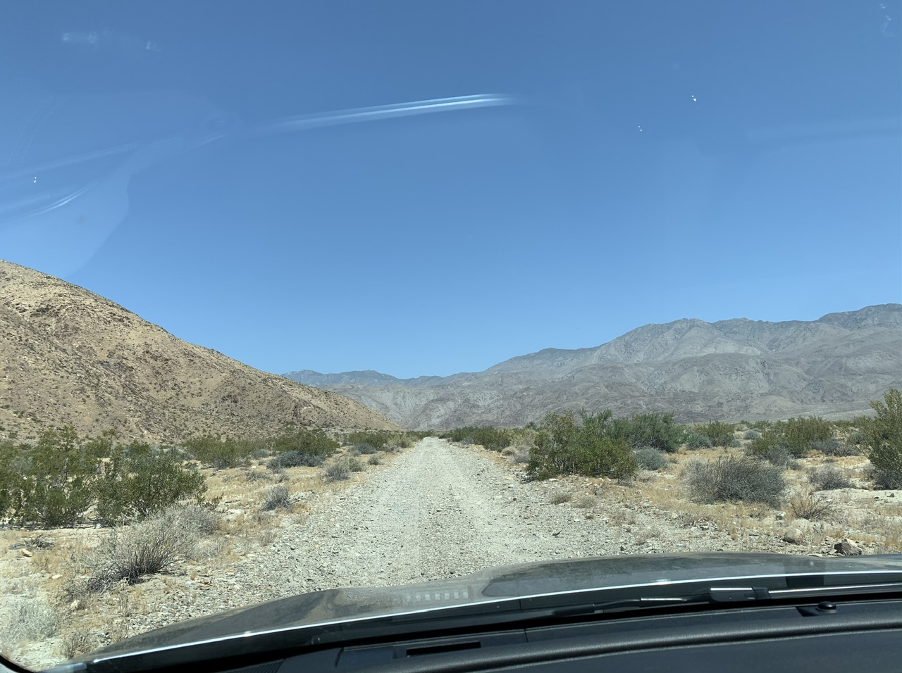
Over all a very nice day in the desert. No gold, but had a great time enjoying the vast solitude. Always bring plenty of water, snacks, sunscreen and a hat, four wheel drive helps.
IDA |
|